Curated OER
Real World Investigation- Math and Geography- Elevation Changes
In this math and geography real world investigation, 6th graders plan a driving trip to a city that is located several states away from their home while recording the elevations of three cities that are included in the trip. They use...
Curated OER
Extreme Elevations
Seventh graders use highest and lowest points of land elevation around the world to find the differences. Sea level is zero, so students be operating with positive and negative numbers. After students find the information on the...
Curated OER
European Elevation Sort
Given a prepared database of European countries, sixth graders sort the countries in ascending order by elevation and identify the five countries with the highest elevations. This cross-curricular activity combines elements of computer...
Curated OER
Land Elevation
Students investigate land elevation. In this map skills lesson, students use a physical map to identify various elevations of the land. Students find landform features such hills and coastlines.
Curated OER
United States Map- Land Elevation
Learners explore a physical map. In this map skills instructional activity, students discuss examples of elevation and investigate the symbols used to identify elevation on a map. Learners use the map to identify various land elevations.
Curated OER
Cookie Topography
Students construct a cross section diagram showing elevation changes on a "cookie island." Using a chocolate chip cookie for an island, they locate the highest point in centimeters on the cookie and create a scale in feet. After tracing...
Curated OER
Contour Map Worksheet #4
There are only four questions here. There is a contour map of Cottonwood, Colorado and the creek that crosses it. Earth scientists tell in what direction the creek flows, identify the highest elevation on the map, draw a topographic...
iCivics
Step 8: Talk It Up
You have 30 seconds to sell your idea ... go! Scholars master the art of the elevator pitch in the eighth step of a 10-part series. They use research, practice, and step-by-step planning to gain a better understanding of the method....
Curated OER
Tracing Highs and Lows in San Francisco
On a topographic map, students identify the scale bar, north arrow, and contour interval. They then locate a hill on the map and make note of the contour lines. Students then locate other places with similar contour line patterns....
Curated OER
Exploring Hawaiian Mountain Zones
Fourth graders watch a video that describes the climate and vegetation zones of Hawaii. They describe the different physical conditions that create vegetation zones from the sea to the mountains. In groups, they create an illustrated...
Curated OER
Customized Topographic Maps and Models
Students explore the information depicted on topographic maps. They construct a 3-D topographic map of a local area. They go on a field trip to the depicted area and compare the 'real world' with their models.
Curated OER
Understanding Topographic Maps
Underclassmen create a cone-shaped landform and then draw a contour map for it. Then they examine a quadrangle (which was easily located with an online search), and relate it to what they experienced. The accompanying worksheet is...
Curated OER
"L" Stands for Elevated
Students play a trivia game to learn more about the Chicago public transportation system. In this transportation lesson plan, students also create an "L" car, and write advertising slogans for Chicago's elevated trains.
Curated OER
Extreme Elevations
In this geography worksheet, 5th graders work in groups in order to locate and graph mountains found on all the continents of planet earth.
Curated OER
Highest Cities in the USA
In this online interactive geography quiz worksheet, students respond to 32 identification questions regarding the highest elevated cities in the U.S. Students have 4 minutes to finish the timed quiz.
Curated OER
What Do Maps Show?: Lesson 4 How to Read a Topographic Map
Students examine the use of topographic maps as two dimensional representations that show elevations and slopes with contour lines. They read maps of the Salt Lake City, Utah area and complete the associated worksheets that show map...
Curated OER
Lesson Design Archaeology- USGS Maps
Students research USGS maps and identify the major features. In this map skills lesson, students identify low and high elevations on a USGS map and practice finding latitude and longitude.
Curated OER
Damage Control
Pupils investigate artificially elevated regions or cities around the world to compare histories, cultures, and strategies related to potential flooding disaster.
Curated OER
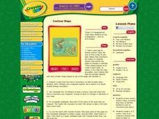
Contour Maps
Students review various contour maps, including local ones, to identify landforms such as mountains and plains. They create a 3-D contour map of an imaginary location that shows at least 10 changes in elevation. Afterward, they write a...
Curated OER
Layers with Lines
Students examine topographical maps and the challenges faced by cartographers when drawing the maps. While creating collages, they use contour lines to add dimension much in the same way they are used on maps to show elevation.
Curated OER
Kansas Land
Fourth graders discover the geographic regions of Kansas. For this geography lesson, 4th graders explore the different regions of Kansas and determine how the different geography affects daily life in Kansas.
Curated OER
Cross Section and Slope
Students draw cross sections of given contour maps. In this math lesson, students interpret the different symbols used in the map. They determine slope and steepness through direct measurement.
Montana State University
Meet Mount Everest
Learning about one landform might seem boring to some, but using the resource provided practically guarantees scholar interest. The second in a sequential series of eight covering the topic of Mount Everest includes activities such as a...
Montana State University
Who’s on Top?
What's it like to climb Mount Everest? An educational resource encourages an in-depth knowledge of Mount Everest's scientific missions through a variety of activities, including an analysis of maps, a KWL chart, videos, a simulation, and...
Other popular searches
- Angle of Depression/elevation
- Angle of Elevation
- Elevation Plans
- Boiling Point Elevation
- Elevation Maps
- Land Elevation
- Contour Maps and Elevation
- Elevation Relief Map
- Angles of Elevation
- Elevation Changes
- Map Elevation
- Plans and Elevations


