Curated OER
Real World Investigation- Math and Geography- Elevation Changes
In this math and geography real world investigation, 6th graders plan a driving trip to a city that is located several states away from their home while recording the elevations of three cities that are included in the trip. They use...
Curated OER
Cookie Topography
Students construct a cross section diagram showing elevation changes on a "cookie island." Using a chocolate chip cookie for an island, they locate the highest point in centimeters on the cookie and create a scale in feet. After tracing...
Curated OER
Highest Cities in the USA
In this online interactive geography quiz worksheet, students respond to 32 identification questions regarding the highest elevated cities in the U.S. Students have 4 minutes to finish the timed quiz.
Curated OER
Contour Maps
Students review various contour maps, including local ones, to identify landforms such as mountains and plains. They create a 3-D contour map of an imaginary location that shows at least 10 changes in elevation. Afterward, they write a...
Carolina K-12
Preventing Voter Fraud or Encouraging Voter Suppression?
The issues of voter fraud and voter suppression are relevant in every election, local as well as national. Soon-to-be voters learn about a recent bill proposed in North Carolina, the Voter Information and Verification Act, and decide for...
Curated OER
Highest Mountain Countries Quiz
In this online interactive geography quiz worksheet, students examine the chart that includes the elevations of 20 world mountains. Students identify the names of the mountains in 4 minutes.
Curated OER
The World's Tallest Building
Students investigate the world's tallest buildings. In this architecture lesson plan, students discover how humans change the physical environment. Students read about and view pictures of famous buildings in the world. Students make...
Curated OER
Generate an Accurate Landscape Profile from a Topographic Map
Learners enerate an accurate landscape profile from a topographic map. They determine the correct interval needed to accurately graph the change in elevation on a single piece of graph paper.
Curated OER
Building a Topographic Model
Students explore the features of a topographic map. They make paper models that portray, in three-dimensions, features represented by contour lines on a topographic map. Students demonstrate different elevations shown on a...
Curated OER
Building A Topographic Model
Students visualize, in three dimensions, features represented by contour lines on a topographic map. They see that the different elevations shown on a two dimensional topographic map can be used to build a 3-D model.
Curated OER
Science: Draining the Land - the Mississippi River
Students use topographic maps to identify parts of rivers. In addition, they discover gradient and predict changes in the channels caused by variations in water flow. Other activities include sketching a river model with a new channel...
Curated OER
Dr. King and His Advice for Dreams Deferred
Young scholars analyze Dr. King's public addresses and Langston Hughes' poetry as a study of the Civil Rights' nonviolent approach to making an impact. In this protesting lesson, students read poetry of Hughes and speeches by Dr. King as...
Curated OER
"Across Oregon On The 45th N Parallel" A Transect of Oregon
Students explore the physical geography of Oregon. In groups, students collect weather and elevation information on Oregon. They organize the data and create maps and graphs of the information. Afterward, students compare the...
Curated OER
Learning Lesson: The Shadow Knows I
Learners examine the elevation of the sun to discover the changes in seasons. They observe and measure the length of their shadow. They compare this measurement to one taken four months later.
Curated OER
Planning A Railroad
Students use topographical maps students explain the challenges involved in building the railroad in the Sierra Nevada mountains.
Montana State University
What's the Weather?
How many jackets do you need to stay warm and climb Mount Everest? An informatie resource covers the topic of Mount Everest, the resource helps young scientists discover the difference between climate and weather. Activities include...
Curated OER
Planning A Railroad Online Lesson
Students plan a route across Donner Summit using topographical maps in order to understand the challenges involved in constructing the railroad in the Sierra Nevada Mountains. In this history lesson, students first discover how to read...
Curated OER
Lesson on GPS
Students investigate global positioning systems. In this technology and mapping lesson plan, students view a PowerPoint presentation in which they identify the features of a GPS, state its uses, and follow steps to find a waypoint.
Curated OER
Privacy in the Age of Video Surveillance: This Is Not Your Father's Candid Camera
Eighth graders examine the use of video surveillance in the corporate world and other life situations. In groups, they determine how many times and in what situations they believe they are being watched. They use the Constitution to...
Curated OER
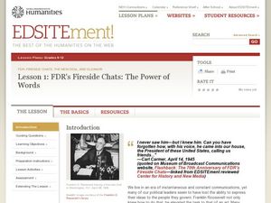
FDR's Fireside Chats: The Power of Words
High schoolers examine Franklin D. Roosevelt's Fireside Chats. In this presidential history lesson, students listen to the radio broadcasts of select FDR Fireside Chats. High schoolers analyze the effectiveness of his messages to the...
Curated OER
Breaking News: Shopping Carts Covered in Bacteria (5th March, 2011)
Students explore current events by completing several worksheet activities. In this bacteria infections lesson, students read a current news story of the germs associated with shopping carts and how people should protect themselves....
Curated OER
Eagle Creek Park (A Hike)
Students plot a hiking course using aerial photos and a topographic overlay and find the latitude and longitude of absolute locations. They measure the total distance of a hiked area and figure the area of the ground walked using Heron's...
Curated OER
Introduction To Topographic Map Activities
Students discuss different types of maps, their similarities and differences. Using a Topographical Maps CD-rom program students create their own map.
Curated OER
Hot, Wet, and Cold
Students research climate data for a city in each of the 5 major geographic sections of Texas. They use data to describe the climate and what influence the geography of that section has on the weather.


