Owl Teacher
Creating a Map to My House
Here is a simple assignment that will introduce your young geographers to location, one of the five themes of geography, through an activity in which they map the directions and lines of latitude/longitude of where they live.
Curated OER
Arkansas is Our State: Differentiating Between a State and a Country
An ambitious geography lesson is geared toward kindergartners. They discover what the differences are between states and countries. They look at maps of Arkansas, and learn what the shapes and lines mean. Additionally, they create a...
Curated OER
Topographic Mapping Skills
In this geography instructional activity, students read an excerpt about topographic maps and why they are useful for various jobs. They also respond to eleven questions that follow related to the excerpt and locating specific map points...
Curated OER
Listen to Grandfather - Say and Write Korean Words
Students create a calligraphy piece using Korean words. They use han'gul script and write with a brush after learning the words. They pay attention to line and space as they create their work of art.
Curated OER
Cities
Young scholars examine U.S. Census figures. In this urban centers lesson, students compare city populations across the span of 50 years. Young scholars create line graphs based on the data.
Terry Kawas
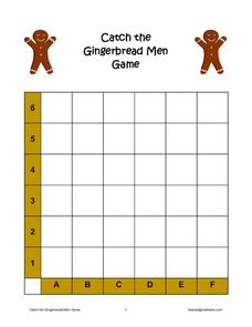
Catch the Gingerbread Men Game
Catching men made of gingerbread motivates your young graphers to begin exploring the concept of finding a point in two-dimensional space. Learners practice locating each cookie by rolling two cubes (one with...
Curated OER
Animal Morphs
Learners explore animal drawing. In this cross curriculum drawing, photography, and animals lesson plan, students combine computer drawing and freehand drawing to create an animal and its environment using a photograph of...
Curated OER
Linking Lines to Landscape
Students evaluate art to enhance their core knowledge of fiction, American folk heroes, and the water cycle. In this art lesson, students complete a unit of activities to use art to study various topics of literature, history, and...
Curated OER
Lines and Dots
Pupils develop a strategy to win the game. Charlie Taylor is trying to get his engine built for the Wright Brothers before Charles Manly gets his done for Samuel Langley. The person who completes the most boxes is the person who gets his...
Curated OER
Cross Section and Slope
Students draw cross sections of given contour maps. In this math instructional activity, students interpret the different symbols used in the map. They determine slope and steepness through direct measurement.
Curated OER
Holiday Timeline
Students create a timeline to represent state and national holidays. In this social studies lesson, students use colored popsicle sticks along a line drawn on a piece of paper to illustrate when holidays occur.
Curated OER
The Art and History of Japanese Calligraphy
Chinese and Japanese calligraphy is beautiful and significant in both culture and tradition. Engage your class in this expressive fine art form through a lesson on using, holding, and creating brush strokes common to Japanese writing...
Curated OER
Latitude/Longitude Activity
Youngsters work in groups to solve clues involving latitude and longitude coordinates in order to decipher mystery animals in this fun learning experience!
Curated OER
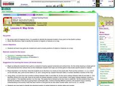
Map Grids
Students examine how grids are created and used to locate positions of objects or features on a map.
Curated OER
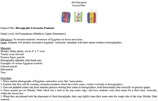
Hieroglyphic Cartouche Pendants
In ancient Egypt, mummified bodies were embellished with elaborate cartouches housing the name of the deceased. Elementary artists can read all about Egyptian burial practices then create a cartouche of their own using clay and real...
Curated OER
Where is ? ? ? ?
Students explain and explain the concept of a grid system. They define absolute and relative location and develop an imaginary city on graph paper using a grid system.
Curated OER
Classroom Management Systems- Part 3
The "Weekly Section Winner" is the third of my classroom management systems.
Curated OER
Lewis and Clark Review
Students play games. In this comprehension and recall lesson, students play Give Me A Break, Bingo and Jeopardy to reinforce the knowledge they've learned about Lewis and Clark.
Curated OER
Understanding Latitude and Longitude
Teaching learners about latitude and longitude can get a little complicated. Present the concept by first representing it as a graph. Just like finding a location on a graph using the x and y-axis, learners will be able to locate items...
Curated OER
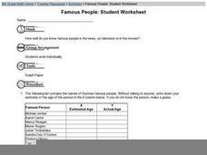
Famous People: Student Worksheet
Older learners consider a list of famous people, and they fill in two columns; one in which they guess the celebrities' ages, and another where they look up their actual age. They construct a graph by assigning one of the columns...
Curated OER
Real World Investigation- Math and Geography- Elevation Changes
For this math and geography real world investigation, 6th graders plan a driving trip to a city that is located several states away from their home while recording the elevations of three cities that are included in the trip. They use...
Brooklyn Museum
"Workt by Hand": Hidden Labor and Historical Quilts
Just like a painting or the symbols on a flag, quilts can express ideas that reflect a cultural context, space, and time. The class discusses the history of quilt making throughout US history and what different types of quilts mean. They...
Curated OER
Where Am I?
Students apply map reading skills by locating places through the use of latitude and longitude.
Curated OER
Are You Ready for Personal Independence?
Third graders discover what independence means to different individuals. They write two paragraphs. In the first paragraph they describe how they are independent. In the second paragraph they describe how they are still dependent.


