Teach Engineering
Stormy Skies
Young meteorologists examine the four main types of weather fronts and how they appear on a weather map. Participants learn about the difference between the types of weather fronts along with their distinguishing features. A...
Captain Planet Foundation
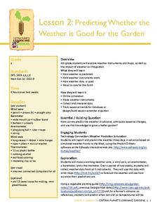
Predicting Whether the Weather is Good for the Garden
Can your class predict the weather? Show them how they can come close with a instructional activity about creating weather instruments, including weather vanes, barometers, wind socks, anemometers, and thermometers. Kids research weather...
Curated OER
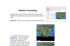
Weather Forecasting
Learners discover how to read a current weather map. In this weather forecasting lesson plan, students view weather maps from three consecutive days and observe how quickly weather moves and changes. Learners review key terms associated...
Curated OER
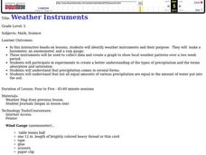
Weather instruments
Students explore weather instruments. In this weather lesson, students make rain gauges, anemometers, and barometers following the instructions given in the lesson. Students set up a weather station using their instruments and record and...
Office of the New Jersey State Climatologist
Play Ball! – Or Not…Making a Decision Using Weather Data
Should the game go on or not? An engaging lesson asks small groups to make a decision using weather data. After analyzing a map, an updated forecast, and radar information, groups have to decide whether to cancel a baseball game. They...
Curated OER
What Do Maps Show?: Lesson 1 Introduction to Maps
Students brainstorm a list of the different types of maps they have seen or used. Using the activity sheet, they look through a social studies book to find all the maps and to determine what they are used for. Using a poster, they review...
Curated OER
Create a Weather Newscast
Fourth graders explore and study basic weather terms, strengthen research skill on the web and create a weather newscast. They choose a weather site on the web, copy weather maps and create a videotape based on a written script to...
Curated OER
The Weather
Students explore earth science by reading articles in class. In this weather identification instructional activity, students analyze weather science articles on the Internet and view their own local weather patterns as well. Students...
Curated OER
Weather Analysis - Lab Activity
Ninth graders perform research in the subject of weather to answer several key questions to increase comprehension of concepts. Students use weather prediction as an application for the research.
Curated OER
Storm Clouds-- Fly over a Late Winter Storm onboard a NASA Earth Observing Satellite
Students study cloud data and weather maps to explore cloud activity. In this cloud data lesson plan students locate latitude and longitude coordinates and determine cloud cover percentages.
Curated OER
Introduction to Maps
Students investigate a variety of maps to explain what each one is used for.
Curated OER
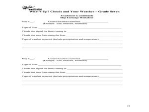
What's Up? Clouds and Your Weather
Seventh graders identify clouds and the weather that is associated with them. For this weather lesson students work in groups and design their own weather map.
Curated OER
Observing Weather
Students investigate the weather by reading children stories. In this weather observation lesson, students read Cloudy With a Chance of Meatballs and several other stories about weather before they create a KWL chart....
Curated OER
Weather Watchers
Second graders discuss what weather is and list words that can be used to describe weather. In this science lesson, 2nd graders develop symbols for each type of weather and record the weather for two weeks at the same time and the same...
Curated OER
Water Cycle, Weather, and Climate
Eighth graders investigate the water cycle and its processes. They examine temperature and precipiation data to classify climate of ten cities. They then create a climate map of the world.
Chicago Botanic Garden
Climate Change Around the World
Look at climate change around the world using graphical representations and a hands-on learning simulation specified to particular cities around the world. Using an interactive website, young scientists follow the provided...
Curated OER
What Do Maps Show?
Students discover the uses for various types of maps. In this geography skills lesson, students discuss the type of maps that exist and what their individual features are. Students then practice using different types of maps.
Curated OER
Introduction to Maps
Students develop their map skills. In this geography lesson, students participate in an activity that requires them to survey their social studies book in order to find different types of maps and purposes for their uses.
Curated OER
Weather Symbols
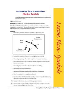
Learners study weather symbols. In this weather symbols lesson, students review the symbols for cold, warm, and stationary fronts. Learners use a weather map to study the weather symbols, complete a weather illustration and prediction...
Curated OER
Clouds and Your Weather
Seventh graders identify clouds and the weather associated with them. They use informational articles and personal weather observations to learn about the relationships between weather fronts and clouds.
Curated OER
A Comparison Study of Water Vapor Data to Precipitation over North America
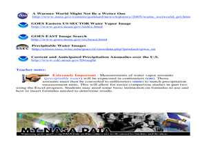
Students use NASA satellite data to compare water vapor over the United States. In this data analysis instructional activity students use an Excel spreadsheet to map their data.
Curated OER
Understanding Canadian Weather Extremes
Students research and analyze the causes and sources of Canada's extreme weather conditions. They conduct an experiment, complete a worksheet and predict the most likely locations for extreme weather conditions.
Curated OER
Quiz: Weather Prediction
In this science worksheet, 3rd graders will focus on the weather. Students will respond to ten fill in the blank questions regarding weather prediction.
Curated OER
Mapping the Border
Students create maps of the borderland region. They decorate their maps with colors, pictures, icons, scenes, words that reflect their understanding of the character and history of the borderland.

