Curated OER
El Mundo Hispano
Colorful maps are clearly labeled in this PowerPoint to show viewers where different Hispanic countries are located within Central and South America. Each country is listed on its own slide with a title, the capital, close-up map, flag,...
Curated OER
Africa: A Cultural Safari
Students examine the kingdoms of West Africa during the Middle Ages. They label maps and identify Africa's physical features, simulate the trading of gold, buy and sell goods using cowrie shells, and participate in a cultural safari day.
Curated OER
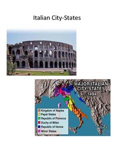
Italian City-States
Check out this packet of worksheets involving mapping activities, vocabulary logging, reading and comprehending informational texts, etc., which focuses on Italian city-states during the fourteenth and fifteenth centuries. There are also...
Curated OER
Energy Resources: Where Are They and How Do We Get Them?
Future energy engineers visit several stations, each one dedicated to a different alternative source of energy. They describe how solar energy is converted into other forms of energy, the patterns of distribution of energy resources in...
Curated OER
Geography/Current Events Project
Using the Balkan region as an example, fourth graders review the five themes of geography as a class. They identify the physical and human characteristics of a region before labeling the countries and landforms on a map. They then...
Curated OER
Book: Germany
Students, after reading Chapter One in the book, "Germany," analyze and recreate the political boundaries as well as the physical features of the nation of Germany with the assistance of play-doh or salt dough. In groups, they create...
Curated OER
About Life: The Photographs of Dorothea Lange Going to the Promised Land
To better understand the migrant experience during the Great Depression, pupils analyze two primary resources: photographs by Dorothea Lange and a U.S. Map that shows the Dust Bowl. They compare and contrast Lange's images to Steinbeck's...
Curated OER
8th Grade Math Parallel and Transversal Lines
Eighth graders label and define geometrical lines and angles. They identify angles on the board as acute, obtuse, straight, or right. In groups, 8th graders build with masking tape on the wall a pair of parallel lines, and a transverse...
Curated OER
Animal Farm Chapter 2 Discussion Notes and Mini-Project
Imagine having the opportunity to create your own country. After responding to questions about chapter two, readers of George Orwell's dystopian classic are given a chance to design a utopia for one-million people, complete with...
Curated OER
State or Region Project
Invite your youngsters to learn about a state or region through their choice of a creative project. The resource lists 15 project options that range from a 3-D map of the area, to a puppet show about the region. Pupils can also propose...
Illustrative Mathematics
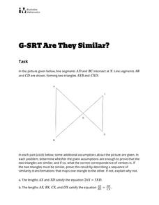
Are They Similar?
Learners separate things that just appear similar from those that are actually similar. A diagram of triangles is given, and then a variety of geometric characteristics changed and the similarity of the triangles analyzed. Because the...
Super Teacher Worksheets
My Explorer Report
This is the perfect resource to accompany your class project on famous explorers! Learners detail basic information about their chosen explorer, his/her main events of exploration and means of transportation, and finally,...
Curated OER
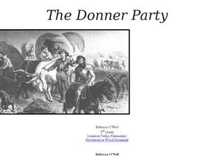
The Donner Party
Who is the Donner Party? Find out why this group of pioneers lives in infamy. A lot of information is provided in this resource, but you will have to copy and paste the text to acquire the handouts. Learners will look at primary sources,...
Curated OER
The Birth of the Ancient Games: The Olympics
This exercise includes a lengthy article on the history of the Olympics as well as a map of Ancient Greece. The last page includes 15 reading comprehension questions about the passage. A fairly thorough look at this topic - geared toward...
Curated OER
Location on a Grid
Make coordinate pairs more engaging by having beginners color-code a grid based on given locations. The grid has numbers along the y-axis and letters along the x-axis, introducing them to the ordering of coordinate pairs with the x-axis...
Curated OER
Reflections and Equilateral Triangles II
Given the lines of symmetry in an equilateral triangle, your learners find where the pre-image vertices are mapped onto the new image. They explore the properties of equilateral triangles, the impact of reflections, and the...
Curated OER
Volcanoes: Second Grade Lesson Plans and Activities
Young geologists explore volcanoes with a series of engaging geology activities. First, they learn the difference between magma and lava before coloring and labeling the parts of a volcano. During the lab, individuals watch a...
Curated OER
Let's Learn About Plants!
After listening to From Seed to Plant by Gail Gibbons, learners take a walk around their school looking for plants. They use digital cameras to photograph the plants, then construct a class book which has the identities of the plants,...
Curated OER
Learn to Earn When you Tend to Spend
Analyzing and understanding word problems is extremely important. Pupils learn that in money problems, earn usually means you add and spend usually means you subtract. They will solve a series of money-related word problems, label coins,...
Environment Agency - Abu Dhabi
Plate Tectonics
Young scholars observe a presentation on plate tectonics, layers of the earth, and plate boundaries. They then use the Internet to research major plates and label them on a world map.
Inside Mathematics
Vencent's Graphs
I like algebra, but graphing is where I draw the line! Worksheet includes three multiple-part questions on interpreting and drawing line graphs. It focuses on the abstract where neither axis has numbers written in, though both are...
Curated OER
Distances Between Houses
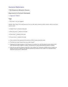
This resource sneaks in the math so your learners will be adding and subtracting positive and negatives on a number line while thinking they are mapping out houses. The activity starts by putting houses the appropriate distance away from...
Curated OER
Hazards: Second Grade Lesson Plans and Activities
Equip learners with safety knowledge in the case of an earthquake. After coloring the places to go to get help after a quake, and label places that wouldn't be safe to go after a quake, young geologists simulate three levels of...
Science Matters
A Model of Plate Faults
The San Andreas fault is one of the longest fault zones in the world. In a series of 20 lessons, the fourth lesson has pupils use a paper model to recreate various types of plate faults. Each is held in position then drawn...
Other popular searches
- Map Labeling
- Africa Map Labeling
- Midwest Map Labeling
- Geography Map Labeling
- Labeling a Map Continents
- Blank Labeling Maps
- Labeling Maps Pangaea
- Labeling Map Parts


