SeaWorld
Marvelous Manatees
Here is an interesting lesson on the manatee for your upper graders or middle schoolers. A game is played where learners work together to complete a successful manatee migration. It's a board game, and all of the game components are...
Curated OER
Soils
Students apply knowledge of soil, environmental impacts, economics, multiple human demands, and use given data for a proposed scenario in making land use decisions. They debate land use issues and/or scenarios and discuss a case study.
Curated OER
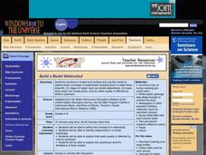
Build a Model Watershed
Collaborative earth science groups create a working model of a watershed. Once it has been developed, you come along and introduce a change in land use, impacting the quality of water throughout their watershed. Model making is an...
Nuffield Foundation
Observing Earthworm Locomotion
One acre of land can contain more than a million earthworms. Scholars collect earthworms to observe their movements. Once placed on paper, the sound of movement often fascinates pupils. When placed on glass, the earthworm is unable to...
Curated OER
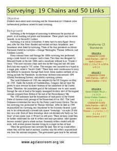
19 Chains and 50 Links
Students investigate surveys as it relates to chains and links. In this math lesson, students relate math to history and surveys done above, below and on the earths' surface. They review vocabulary pertaining to this lesson before moving...
Curated OER
Free Land
Students investigate the impact of the passage of the Homestead Act. In this Westward Expansion lesson, students visit selected websites to examine the lives of Americans who settled the American frontier.
Curated OER
Build Illinois
Learners examine the history of the formation of Illinois. Traveling virtually between time periods, they describe each period and compare them with how Illinois is now. They work together to complete an activity and worksheet.
Curated OER
Soil Survey Lesson
Students use materials to research the soil in their local area. They complete worksheets with the information they gather and locate the areas on a soil survey map. They share their information with the class.
Curated OER
This Land is Ours
Students research and present their findings of the Native American's forced removal in the 19th century. In this Native American lesson plan, students read passages, write and reflect, and look on the internet for evidence of the Native...
Curated OER
Water Quality Survey
Pupils identify the differences in the water quality of a stream and complete water testing. In this water quality lesson students collect aquatic insects and identify them.
Curated OER
Runoff: Intro to Watersheds
Students are taught that a watershed is, what types of basic land cover are impermeable and permeable to water. They trace the flow of water around their school and around their home. Students determine what watershed their school is a...
Smithsonian Institution
Picturing George: A Pictorial Survey of the Life of George Washington
Students create pictorial biographies of George Washington. Working in groups, they research various portions of Washington's life, highlighting significant events. After presenting their projects to the class, they are displayed for...
Curated OER
Science: Draining the Land - the Mississippi River
Learners use topographic maps to identify parts of rivers. In addition, they discover gradient and predict changes in the channels caused by variations in water flow. Other activities include sketching a river model with a new channel...
Curated OER
The Art and Soul of the Land
Students study conservation and how different communication styles used by different conservationists. In this conservation activity students obtain information on a cartoon or a few quotes from a conservationist and are ask to describe...
NOAA
Mapping the Deep-Ocean Floor
How do you create a map of the ocean floor without getting wet? Middle school oceanographers discover the process of bathymetric mapping in the third installment in a five-part series of lessons designed for seventh and eighth graders....
Beyond Benign
Ecological Footprint
How does your lifestyle measure up in terms of your ecological footprint? Young ecologists examine their impact on the planet using an insightful online calculator. A short quiz asks users to rank the size of their homes, their energy...
NOAA
Watching in 3D
Bring the ocean floor to life! Earth science scholars discover the process of deep sea mapping in the third installment in a series of five lessons about ocean exploration. The teacher's guide includes helpful resources, worksheets, and...
Curated OER
Water Walk
Students conduct a visual survey to discover information about local land use and water quality; document their findings by mapping and profiling the water body; and use this initial investigation to raise questions about local land use.
Curated OER
The Colony of Virginia as Far as the Mississippi
Students study George Washington's map and journal of his 1754 expedition to the French. They draw conclusions about the importance of western lands and the problems involved in tapping the resources of the West during that era.
Curated OER
One Square Meter
Students examine various ecosystems using scientific inquiry. Using the local area, they assess the characteristics and conditions in one square meter. They report their findings in the form of a survey map and data sheet. They...
Curated OER
Economics: Property Rights and the Rule of Law
Pupils examine the economic value of property rights. In a classroom activity, "You're the Economist," they analyze actual research data from establishing land holding titles in Para, Brazil. They assess several case studies about the...
Curated OER
Yearly Place Based theme
Learners are awaken to their surroundings. They gain a greater access of how their city was formed. Students assess the human impact on the land. They comprehend the cultural diversity of the city.
Texas Instruments
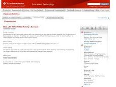
REAL LIFE REAL WORLD Activity - Surveyor
Learners investigate surveying in this secondary mathematics lesson. They will explore a real world application of geometry and trigonometry as they create a plot plan using a geometry utility and calculate the area of the land parcel.
Curated OER
Arthur Young and the President
Students work with NASS data by converting it into prose. In this historical agriculture information lesson, students read about how George Washington communicated information about crop yields, livestock, and land values. They apply the...
Other popular searches
- Land Survey Math
- Public Land Survey
- Land Survey Construction
- Land Survey System
- Land Surveying Math
- History of Land Surveying
- Land Survey Math Measurement
- Geometry Land Surveying
- Land Surveyor
- Geometry and Land Surveying
- Land Surveying Egypt


