Curated OER
MAP Practice
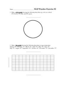
In this geometry activity, students create circle, line and bar graphs using different comparisons of events. There are 24 questions with an answer key.
Curated OER
Cookie Mapping
Students study the components of a bedrock geology map through a hands-on activity involving a cookie and graph paper.
Illustrative Mathematics
Similar Triangles
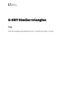
Proving triangles are similar is often an exercise in applying one of the many theorems young geometers memorize, like the AA similarity criteria. But proving that the criteria themselves are valid from basic principles is a great...
Curated OER
Robot Cartography
Students identify points plotted on the coordinate plane. In this geometry lesson, students learn to read a map using concepts of a coordinate plane grid. They find the path given a map to tell them where to go.
Curated OER
Fly on the Ceiling
Fourth graders play variety of games to help them explain coordinates.
Curated OER
Earth on the Earth
Fourth graders plot points on a graph and transfer those coordinates onto a large scale model resulting in an outline of the Western Hemisphere. They identify the major geographical landforms of the Western Hemisphere.
Curated OER
Trigonometry: Worksheet for Test #4
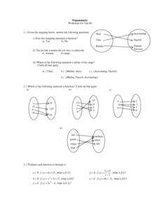
In this trigonometry worksheet, students determine whether given mappings are functions. They evaluate 5 functions for a given x value. Students graph 2 functions. They determine which ordered pairs are solutions to given functions....
Curated OER
Plotting Points
In this coordinate pairs worksheet, students learn to plot points on a graph. Students study the examples and then complete 20 questions. This is intended as an online activity, but may be completed with pencil and paper.
Curated OER
Lagoon Lake
Students develop skill in using co-ordinates. Up to eight cardinal points of the compass are used making this a useful activity in simple map and grid work. They utilize educational software to gain practice.
Curated OER
Mapping Africa
Learners identify the location of parallel and meridian coordinates. They illustrate their understanding of the physical shape of the continent of Africa through a mapping activity, then explain the processes that have influenced the...
Curated OER
Estimation, Sampling, and Beyond
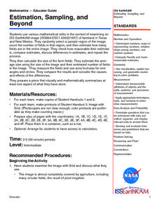
Students examine an ISS EarthKAM image of farm land in Texas and New Mexico. They select sample region of image and count the number of fields in that region. They estimate how many fields are in the entire region.
Mathed Up!
Translations
Introduce translations as transformations that move figures in horizontal and vertical distances with a video that shows how to translate the figures. A second video covers how to determine the translation that has occurred. Pupils work...
Mathematics Assessment Project
Aaron's Designs
Learners first create designs for greeting cards by applying transformations of shapes on a coordinate plane, and then determine a sequence of transformations that produces a given design.
Curated OER
Where is it?
Young scholars use a coordinate grid. They investigate and discuss what caused certain objects to be in specific places. They choose a room in their home to map and place objects in specific locations.
Curated OER
Where in the World? :Understanding Latitude and Longitude
Students play a grid-based game and devise clues to help classmates locate spots on the globe in order to recognize the value of using longitude and latitude for identifying locations.
Curated OER
Giving Students a Little Latitude
Young scholars use a world outline map to locate places using coordinates of latitude and longitude. They answer questions about places based on their knowledge of the map and on their research and make up more questions of this sort...
Curated OER
Where in the World? The Basics of Latitude and Longitude
Students are introduced to the concepts of latitude and longitude. In groups, they identify the Earth's magnetic field and the disadvantages of using compasses for navigation. They identify the major lines of latitude and longitude on a...
Curated OER
Cartography Project
A lesson involving mapping, the use of a compass, writing and following directions, and exploring the first two themes of geography is here for you. Learners create original maps that show the routes they take through their own...
Curated OER
Bird and Dog Race
Your pupil's pet dog and bird are racing down the city streets. In order to know who is going to win, they better know something about calculating rates, the Pythagorean Theorem, and applying those topics to the map of the city.
Curated OER
What a Site!
Fourth graders are introduced to how to properly create a grid site. In groups, they use Cartesian coordinates to establish the boundaries for the grid and photograph the location of artifacts. They exchange their photos with another...
Curated OER
TE Activity: Nidy-Gridy
Students make a grid and coordinate system map of their classroom as they investigate why it is important to have a common map making system. They look at how landmarks are used for navigating an area.
Curated OER
Measurement and the Illampi Mound Colony
Learners comprehend the basic units of measurement, scale, plotting, and basic grids. Students practice their estimation
and measuring skills and will demonstrate their ability to work well in groups.
Curated OER
Dough Lake Topology
High schoolers practice coordinates and measurements, develop 2D, 3D topological map, construct grid with string on real surface, establish "level" fixed point for measurements, take and record data points of elevation, and enter data on...
Curated OER
Algebra/Geometry Institute Summer 2007: Graphing Activity
Seventh graders practice identifying coordinates by examining a city map. In this graphing lesson, 7th graders create coordinate directions on an index card and practice locating these locations on a grid. Students read and discover...


