Curated OER
The Map Cartouche
Students discuss the history and purpose of cartouches. They examine examples of cartouches and design an original example with symbols of their choosing.
Curated OER
Denali Park Topographic Maps
Students construct a topographic map of the Denali National Park. They identify different elevations and record historic landmarks in student science journals.
Curated OER
Geography of South America
Young explorers study South American geography. They study maps and create a physical map of the Andes themselves! They also research the geography, environment, and the culture of the Andes and present a report to the class.
Curated OER
Rhode Island Map
In this recognizing the shape of the state of Rhode Island worksheet, students fill in the state capital, major cities, and other attractions or follow their teacher made directions. Students write at least 7 answers.
Curated OER
Local History: Mapping My Spot
Students explore maps to discover historical information about their local area. In this mapping and history lesson plan, students use panoramic maps of their own town/city to interpret historical information. Students also...
Curated OER
Waldseemuller's Map: World 1507
Students investigate the 1507 word map. In this world geography lesson, students examine the details of each section of the map and then draw conclusions about how the people of 1507 understood the world. Students are evalated on...
Curated OER
Mapmaker, Mapmaker, Make Me a Map!
Students evaluate the different types of historical and geographical information that one can gather through close study of historical maps from the 16th through the 19th centuries. They create their own maps.
Curated OER
New York Map
In this state map worksheet, students identify the state map of New York. Students fill in the state capital, major cities, and other state attractions.
Curated OER
Nebraska Map
In this Nebraska learning exercise, students explore the state of Nebraska. Students are given a blank map of the state of Nebraska and are to fill in the capital, major cities, and any other state attractions on the map.
Curated OER
Wisconsin Map Activity
In this Wisconsin map worksheet, students fill in the capital, major cities and other state attractions on a blank map of Wisconsin. A reference web site is given for additional activities.
Curated OER
Alabama Map
In this Alabama worksheet, students explore the state of Alabama. Students are given a blank map of Alabama where they are to label the capital city, other major cities, and any other important state attractions on the map.
Curated OER
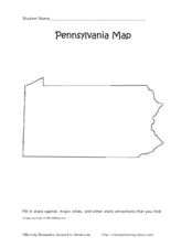
Pennsylvania Map
In this state maps activity, students identify the map of Pennsylvania. Students fill in the state capital, the major cities, and other state attractions.
CK-12 Foundation
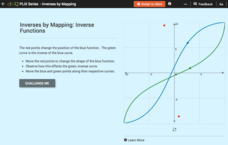
Inverses by Mapping: Inverse Functions
Map your way to successfully understanding inverse functions. Pupils use an interactive map to investigate how changes in the graph of a function affect the graph of its inverse. The results of the activity lead to the conclusion that...
CK-12 Foundation
Whole Number Multiplication: Multiplication Map
How many miles did a car travel if it traveled at 55mph for three hours? What are the factors for this multiplication sentence? These are the questions young mathematicians must solve using a multiplication map.
Curated OER
Simple Route Map
Students identify the best route between various locations on a map. In this map skills lesson, students use a landscape picture map to find routes to and from certain places. Students use map markers to highlight the routes.
Curated OER
Mapping the New World Lesson Plan
Students compare two maps of the same area from different time periods. In this American History lesson, students look at two maps of the English colonies from 1636 and 1651. They discuss why the maps changed and predict maps from the...
Curated OER
Waldseemüller’s Map: World 1507
Students take a closer look at historical maps. In this primary source analysis lesson plan, students examine the first world map produced by Martin Waldseemuller. Students complete the included map analysis worksheet and then write...
Curated OER
Mapping Gymnosperms and Angiosperms
In this plant worksheet, students create a map of a familiar area such as their yard, a nearby park, or the school grounds showing the major plants. On their map they identify the plants in three ways following the example provided. ...
Rainforest Alliance
Protecting the Critical Habitat of the Manatee and Loggerhead Turtle
Explore ocean habitats with a lesson that showcases the home of manatees and loggerhead turtles in Belize. Here, pupils compare and contrast the homes of ocean animals to those of humans, listen to an original short story about...
CK-12 Foundation
Direction on the Earth: Using a Compass
Navigate the world of orienteering in an informative interactive. Earth science scholars learn practical direction skills, such as proper polar coordinates and pairing compasses with maps. The interactive map allows them to practice...
Curated OER
Simple Route Map
Learners demonstrate how to locate features on a Landscape Picture Map. For this map skills lesson, students locate and circle places where they would go to mail a letter, return a library book, or play a baseball game.
Curated OER
A Road Map for the Roman Empire, Ca. 250 CE
Students consider how empires are created and sustained, examine Peutinger Table as a whole and in detail as tool of empire for Rome, c. 250 CE, create ancient time-distance travel chart that synthesizes series of strip maps, and...
Curated OER
Walking on Maps
Students are introduced to the various types of maps and their functions. As a class, they play a game similar to twister to review map concepts. They answer questions about the map and use the internet to view larger maps of the world.
Curated OER
European Union Map Quest
Sixth graders identify countries of the European Union. They locate countries of Europe on a map and pair with a student to complete a blank map of Europe. They label each country and complete worksheets for the European Union. They...


