Curated OER
Storyboards: The Director's Map to a Video Project
Class groups collaborate to produce the storyboard for their video project. After determining the sequence of scenes, the camera angles, and characters in each scene, each group member is assigned a number of scenes to illustrate. When...
Curated OER
Mapping the Human Genome
Young scholars study DNA and how it was discovered. In this biology lesson students see the effects of mapping the human genome would have.
EngageNY
Projecting a 3-D Object onto a 2-D Plane
Teach how graphic designers can use mathematics to represent three-dimensional movement on a two-dimensional television surface. Pupils use matrices, vectors, and transformations to model rotational movement. Their exploration involves...
Science 4 Inquiry
An Investigative Look at Florida's Sinkholes
In May of 1981, the Winter Park Sinkhole in Florida first appeared and is now referred to as Lake Rose. Scholars learn about the causes of sinkholes through an inquiry project. Then, they analyze recent data and draw conclusions to...
Curated OER
Mathematical Roadmaps
Second graders observe how a sample math problem is solved on the overhead. They work in small groups to develop a strategy for solving another problem using counters as well as a large sheet of paper to write down their explanation of...
Geophysical Institute
Latitude and Longitude with Google Earth
Travel the world from the comfort of your classroom with a lesson that features Google Earth. High schoolers follow a series of steps to locate places all over the earth with sets of coordinates. Additionally, they measure the distance...
Curated OER
The East Fork Project
Students identify possible sources of health risks, types of exposures, routes of exposure, and populations that could be affected after discussing water pollution and environmental health hazards. After discussion, students conduct a...
Curated OER
Finding Their New World
First graders place stickers on maps indicating their understanding of the cardinal directions. They locate Jamestown, England, the Atlantic, and Virginia.
Captain Planet Foundation
Adopt-A-Plant
Note the way that plants change during the season by adopting a plant on your school campus. After your class chooses their plant, they research the plant's needs, how it differs from other plants, find ways to support their plant's...
Curated OER
Comparing Time Periods in U.S. History: The Ashford Project
Fifth graders use a "fact book" comparing periods in American history then students create a picture to illustrate their assigned periods. # # students use their pictures and concept maps to write expository paragraphs about their...
Delegation of the European Union to the United States
The Geography of Europe
What is the European Union? Where is it? Why is it? To begin a study of the EU, class members examine the physical geography of Europe and the size and population density of 28-member countries in comparison to non-member countries like...
Curated OER
Stadiums in America
Let's play ball! A great springtime activity to learn about ratios. This activity challenges learners to draw stadiums to scale on standard letter paper and also on construction paper. This three-day lesson includes a pre-assessment...
Curated OER
Inches Away
Learners are introduced to maps, scale representations, ratios and cartography. They plot the itinerary for their family's dream vacation or a trip across the United States. Using maps, they determine the short route and second longer...
Curated OER
The Ridge Exploring Robot
Students study about an autonomous underwater vehicle and explain the strategies that it uses to locate and map hydrothermal vents. In this marine navigation lesson students design a program for an AUV survey.
Curated OER
Using Repeat Photography to Map Environmental Hazards
Students investigate the changes of their environment by experimenting with photography. In this environmental observation lesson, students compare historic photographs of areas with pictures they have just taken. Students create a...
Curated OER
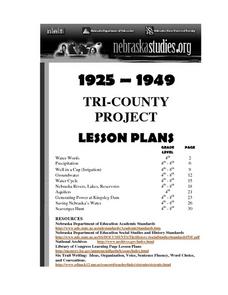
Tri-County Project: Precipitation
Students examine and research the annual rainfall in Nebraska. They create a map of the annual rainfall in Nebraska and use the map to develop explanations of settlement.
Mathematics Assessment Project
Sharing Costs Equitably: Traveling to School
Drive or take the school bus? Class members determine the amount each student would have to pay in a carpool situation. They then evaluate the cost in a set of provided examples. I think I'd rather take the school bus!
National History Day
No More Sticks and Stones: Technological Advancements in World War I Warfare
Remind young historians that many technological advancements influenced the events of World War I. After analyzing technology's evolution through primary sources, discussing the changes over time, and watching various video clips,...
Space Awareness
How Light Pollution Affects the Stars: Magnitude Readers
Did you know light can decrease visibility? Light pollution absolutely makes it more difficult to see stars. Scholars build a simple magnitude reader to determine the magnitude of stars. They use these data to estimate the impact of...
Curated OER
The Three Gorges Dam- Should it be Completed?
Students research and analyze the geographic problem of whether or not the Three Gorges Dam should be completed. Students take a position on the issue, gather information related to their position, present their conclusions, and write a...
Curated OER
Fossil Evidence for Plate Tectonics
Students draw maps of counties that were important to the discovery of plate tectonic theory. In this plate tectonics lesson students excavate constructed fossil sites from matching coastlines and discuss the possible explanations for...
Curated OER
Australia: the Land Down Under
Students give a solid history and geographic explanation of the country of Australia and explain why it is important. They use some creativity in designing their own island, by using the physical features of this particular country.
Curated OER
Patterns
Fifth graders recognize shape and number patterns. In groups, 5th graders use strategies to find patterns. They extend the patterns and give explanations as to how they found the pattern. Students use the computer and the hundreds...
Curated OER
An Ancient Greek and Roman Festival
Third graders label a map of ancient Greek and Roman civilizations and do a written report on one element of these two cultures. They participate in discussions of food, farming, daily life and government (among others). Students use the...


