Curated OER
Identify Base Words and Suffixes to Read Multisyllabic Words #1
Show your scholars how adding an affix changes the entire meaning of a word; they focus on the suffix -able. You'll find a complete script here, but if you don't want to read this verbatim, use it simply as an outline. Learners...
Curated OER
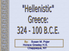
Alexander the Great and Hellenistic Greece
Visual images, maps, and notes on the great philosophers and scientists of Hellenistic Greece await your class. While light in terms of text, the presentation provides images that should help you to describe the area and reign of...
US Environmental Protection Agency
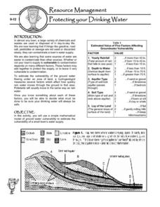
Protecting Your Drinking Water
Having a clean, reliable source of drinking water is essential for any community, but in many cases this is easier said than done. Engage young environmentalists in exploring the five factors affecting vulnerability of a groundwater...
Houghton Mifflin Harcourt
Nature’s Fury: Extra Support Lessons (Theme 1)
Earthquakes, hurricanes, volcano eruptions, and more. To enrich their study of nature's big events, kids map tectonic plates and major earthquake locations, identify emergency response agencies, and storyboard a film about volcanos.
Polk County Public Schools
The French and Indian War
Sharpen those pencils and get to writing with a series of document-based questions about the French and Indian War. High schoolers focus on maps, letters, and other primary documents from the 18th century before answering writing prompts...
Curriculum Corner
Fairy Tale Unit of Study
What makes a fairy tale a fairy tale? Use a 27-page packet to supplement your next fairy tale unit. With sequencing activities, story map worksheets, character analyses and story elements graphic organizers, and fairy tale highlight...
ProCon
Israeli - Palestinian Conflict
Many people think the best solution to the Israeli-Palestinian conflict is a two-state solution. After reviewing the available resources, scholars determine whether they agree with that approach. They analyze graphs and charts about...
Mr. Head's 6th Grade Classroom
Absolute Location
How do we know where we are in the world? A presentation for middle schoolers explains absolute location and other geography terms such as relative location. It also gives scholars the opportunity to practice finding absolute location on...
Curated OER
Pioneer Values in Willa Cather's My Antonia
Included in this resource are a variety of activities to do while reading Willa Cather's My Antonia. The activities, which range from mapping out Nebraska to writing activities about pioneer living, are all designed with one...
Curated OER
Applications of the Pythagorean Theorem - Magnetism
Middle and high schoolers use the Pythagorean Theorem to complete a table showing with the magnetic field strengths in given cities. They find the average value of the Earth's magnetic field and plot one of the three-dimensional values...
Baylor College
Post-Assessment: And Now, What Do You Know About Microbes?
Your life science class works in their groups to review the concept maps that they have constructed over the course of a microbiology unit. They share what they have learned with the rest of the class. In a second session, they are given...
New York State Education Department
Global History and Geography Examination: January 2017
Global history and geography class members demonstrate their knowledge of and ability to analyze primary sources such as graphics, maps, political cartoons, and texts from important documents with an assessment that includes multiple...
Teaching Tolerance
Musical Movement Showcase
Young performing artists create a song or choreograph a dance to illustrate a theme in a text they are reading. Step-by-step directions are included.
Angel Island Immigration Station Foundation
Exploring Oral Histories of Angel Island Immigrants
Empowered by the previous lesson where they interviewed a family or community member, young historians examine Angel Island immigrants' oral histories. They use a matrix to record their interpretation of the feelings of the immigrant....
Angel Island Immigration Station Foundation
How Do Pictures Tell the Story of Angel Island?
Young historians learn more about the history of Angel Island Immigration Station through their analysis of primary source images. Guided by a list of inferential questions, scholars learn how to make and record observations on a...
National Endowment for the Humanities
“The Great Migration” by Minnie Bruce Pratt
Minnie Bruce Pratt's poem, "The Great Migration," offers young scholars an opportunity to reflect on how where we come from influences who we are. Groups conduct a close reading of the poem, recording observations about the poem's...
Curated OER
Navigating Your Community
Students draw a map from memory describing the route between their classroom and the gym including a legend, a compass rose, a map scale, symbols, and a landmark at every change of direction. They then retrace their steps in their maps...
Curated OER
Draw A Coastline
Students identify, locate and draw at least ten different geographical features on a map. Using the map, they must make it to scale and include their own legend and compass rose. They share their map with the class and answer questions.
Curated OER
Geographics in Arkansas
Third graders discuss where Arkansas is located on the United States map. They use geographic tools to participate in activities.
Curated OER
Rivers Run Through It
In this mapping practice worksheet, 5th graders read an informational paragraph and answer 7 questions about the parts of a map along with places shown on a given map.
Curated OER
Give Me a Clue!
Pupils write clue cards for learning the names and locations of each river basin in Kansas using their knowledge of cardinal and intermediate directions.
Curated OER
Exploring Nations
Students, in groups, research countries in East and Southeast Asia. The group designs an oral presentation and PowerPoint slideshow to showcase research on landforms, political and economic issues, global interaction and special-purpose...
Curated OER
From Home To School
Students locate and use internet maps to trace a route from their home to school. They calculate the distance of the route using the map legend then determine the distance they travel to school and back in a regular school week and over...
Curated OER
Planet Earth
Students explore and analyze data from different maps in order to explain geographic diversity among the continents. Student groups research continents' physical features and examine how they contribute to quality of life for inhabitants.
Other popular searches
- Middle East Maps
- Blank Middle East Maps
- Middle East Maps Trade
- Ancient Middle East Maps
- Medieval Middle East Maps
- East Asia Geography Maps
- Middle East Maps Puzzles
- Far East Maps
- Maps South East Asia
- East Africa Maps
- Asking Directions Maps
- Sou East Asia Maps


