Curated OER
We've got the whole world in our hands
Students explore spatial sense in regards to maps about the globe. In this maps lesson plan, students label oceans, locate the continents and poles, follow directions, and explain the symbols on a map.
Curated OER
Do You Know Your 50 States?
Learners use the names and abbreviations of the 50 states to label a blank map of the United States.
Curated OER
Atlantic Basin Hurricane Tracking Chart
In this science worksheet, students look for the location of various storms that develop in the Atlantic Ocean with this hurricane tracking map.
National Geographic
Rescuing, Relocating, and Rehabilitating Wildlife
Bring up the Deepwater Horizon (BP) oil spill that occurred in the Gulf of Mexico in 2010. Display the colorful diagram of the coastal and marine organisms living in the area. Show a video about relocating the eggs of the Gulf's sea...
Curated OER
Bank Loans Money to Start Businesses
After locating Latin American countries on a world map, children read about how microbanks are loaning money to help start small businesses. Involving both current events and economics, the teacher introduces the article with a map...
Curated OER
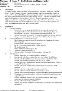
Mexico: A Look At Its Culture and Geography
Students canvass the Mexican geography, culture, dress, language, crafts, and traditions in this unit of eight lessons. The Mexican Independance Day is compared to our own and the contributions of the Mayan, Azetec, and Spanish are...
AGSSS
World Regions
Help your learners to visualize where historical events have taken place around the globe with a map that details the major regions of the seven continents.
Curated OER
Traveling Through Literature
Integrate geography with literature in this interdisciplinary instructional activity. Begin by reading a poem such as The Time We Climbed Snake Mountain by Leslie Marmon Silko. On a large map, place push pins in the cities or states...
Curated OER
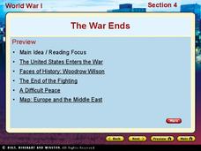
World War I - The War Ends
Your class is in for a treat with this outstanding PowerPoint on World War I. The presentation is loaded with facts, maps, important personalities, and discussion questions on the war. Additionally, there is a wonderful video called,...
Curated OER
Hit The Trail
Young historians research one of the most colorful periods in US History: the cattle drives of the 1800's. They research the three most popular trails, and complete mapping and writing assignments about each one. The lesson has many...
Curated OER
Investigating Latitude and Longitude
Students examine the lines of latitude and longitude on a map, and explain why these lines might be useful. In this lesson plan students also explore websites that provide information to improve their understanding of how and why...
Curated OER
Marine Archaeology
Young scholars examine marine archaeology. In this archaeological data lesson, students see how archaeologists use data to make inferences about shipwrecks. Young scholars read data and make their own inferences, write about marine life...
Curated OER
Different, Yet the Same
Students explore cultural differences. In this cultural differences lesson, students complete a webquest traveling to different countries. At the conclusion of the webquest students create a slide show on KidPix.
Curated OER
The Eagle Has Landed: Aztecs Find a Home
Students investigate the Aztec civilization and locate it on a map. They explain the legend of the city of Tenochtitan and investigate the symbolism of the Mexican flag.
Curated OER
About Life: The Photographs of Dorothea Lange Going to the Promised Land
To better understand the migrant experience during the Great Depression, pupils analyze two primary resources: photographs by Dorothea Lange and a U.S. Map that shows the Dust Bowl. They compare and contrast Lange's images to Steinbeck's...
Curated OER
Hopi Running
Students identify why the Hopi tribe practiced running as it relates to health, delivering messages, defeating other tribes, and for ceremonial events. In this social studies instructional activity, students use maps to identify latitude...
Curated OER
A Dollar Goes A Long Way
Investigate life along the Old Spanish Trail! They visit websites and identify the history and environment. They create journals, dramatic enactments, and maps to discover the role individuals played in society. They also explore the...
Curated OER
The Age of Early European Explorations & Conquests
Your students' world will literally take shape in this presentation, which chronicles the growing edges of the (flat) earth during European Exploration of New Worlds. Dias, da Gama, Magellean, and Columbus are key players in this game of...
Curated OER
Living in the Desert
Conduct an investigation on the plants used by the Hohokam tribe. To survive in the harsh desert environment the Hohokam used many natural resources. Learners read, research, map, and graph multiple aspects of Hohokam plant use as a...
Port Jefferson School District
Hurricane Katrina
Young scientists track Hurricane Katrina across the Atlantic Ocean as they learn about these destructive forces of nature. Provided with a table of data tracking the location and conditions of Katrina over a one week span, students...
Curated OER
Hazards: First Grade Lesson Plans and Activities
Examine the environmental hazards associated with volcanoes with a three-part science lesson. In the pre-lab, first graders learn that gas, landslides, ash, and lava are all hazards that come from volcanoes. They then explore...
American Battlefield Trust
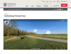
Gettysburg Virtual Tour
Step into one of the most iconic battlefields of the American Civil War with an educational interactive resource. Young historians learn about key moments, locations, soldiers, and turning points in the battle with a clickable map and...
ReadWriteThink
Biography Project: Research and Class Presentation
I Have A Dream ... that after the lesson, all individuals master the reading, writing, researching, listening, and speaking skills the biography project helps them develop. Martin Luther King, Jr. serves as a topic example for a model...
Missouri University of science & Technology
General Overview History of the Panama Canal
Called the Eight Wonder of the World by some and the Big Ditch by others, the Panama Canal is indeed an engineering marvel. The long, complicated, and sometimes controversial history of the canal is captured in a presentation loaded with...
Other popular searches
- Map of Mexico
- Maps and Flags Mexico
- Topographical Map of Mexico
- Blank Map of Mexico
- Map of New Mexico
- Bm Map of Mexico
- Map of Mexico Activity
- Maps of Mexico
- Outline Map of Mexico
- Blanca Map of Mexico
- New Mexico Maps
- Us Mexico Maps


