Curated OER
Food Detectives
Students investigate the regions in which particular grains are grown. Using the packaging from a variety of foods, grains are identified and the general locations where they are grown are plotted on a map.
Curated OER
Silk Roads Big Map
Students create an oversized map from Europe to East Asia. They include information such as Silk Roads, geographical features, major cities and cultural information on their map.
Curated OER
United States Map- Continent, Country, State
Students identify their continent, country, and state on a globe. In this geography lesson, students use a globe to identify the seven continents, the United States, and the state which they live in. Students define key terms.
Carolina K-12
Who the People? Representative Democracy in North Carolina and Congress
Our elected officials are supposed to represent us, but what does it mean when they aren't like us? Budding citizens explore the demographic makeup of the US Congress, the role of money in political elections, and the Citizens United...
Curated OER
Life in Old Babylonia: The Importance of Trade
Students read maps and artifacts for information indicating the existence of a trade network in Old Babylonia and beyond. They list goods imported to and exported from Babylonia. They indicate trading centers on a map of ancient...
Curated OER
Mapping the Middle East
Students examine how the countries of the Middle East were created. They explore the influence of various political and geographic factors in their creation. They list the things they should consider in deciding how to draw new borders...
Curated OER
These Maps are for the Birds
Students identify and study New York State Breeding Bird Atlas maps to learn where different bird species nest and how their distributions have changed over time. They also identify how maps serve as representations of a geographic...
Curated OER
Maps
Students investigate threee types of maps. In this algebra instructional activity, students idenitfy different maps and explore how they relate to the area keeping cllimate and topography in mind. They discuss maps used to navigate...
Curated OER
Cities of the World
Students identify the symbol for cities on a political map. For this world map lesson, students identify specific cities on the World Political Map. Students should identify the country in which the city is located. Students discuss the...
Curated OER
The Oregon Trail
In this Oregon Trail worksheet, learners practice their map skills while they explore the states of Oregon, Missouri, Idaho, Nebraska, and Wyoming. Students us a map of the US to plot six points on the map that show the Oregon Trail.
Curated OER
South US Region
In this United States political map worksheet, students examine the Southern Region state boundaries. The map also highlights each of the state capitals denoted by stars. The states, capitals and major landforms are labeled.
Curated OER
The Lincoln-Douglas Debates of 1858: Interactive Map Activity
Students utilize an interactive map to explore the 1858 Senate campaign in Illinois. They examine how factors such as population, transportation, and party strongholds can affect campaign strategies. Students write an essay discussing...
Curated OER
Mapping the Border
Students create maps of the borderland region. They decorate their maps with colors, pictures, icons, scenes, words that reflect their understanding of the character and history of the borderland.
Curated OER
Waldseemuller's Map: World 1507
Seventh graders analyze various maps. For this Geography lesson, 7th graders create a large map as a whole class. Students write a letter to Mr. Waldseemuller.
Curated OER
Race and Political Representation
Young scholars explore different perspectives dealing with race and politics.
Curated OER
A Map Can Tell a Story
Pupils use colored pencils to label maps of Alabama. They discuss where and if the state constitution should be put into effect. They identify voting patterns in the area and a relationship between areas of Alabama and political opinion.
Curated OER
Bridge to the Future: Enlarging the European Union
The political, social, and economic challenges the European Union faces as it enlarges is the focus of a six-lesson unit. Class members investigate and craft a presentation about a member country, the treaties member states must...
Annenberg Foundation
Teaching Geography: Workshop 4—North Africa/Southwest Asia
Can Jerusalem be equitably organized? Can Israel and Palestine be successfully partitioned? Part one of a two-part workshop looks at the geo-political history of Jerusalem while Part two investigates Egypt's dependence of the Nile River...
Curated OER
Ancient River Valley Civilizations
Ziggurats, cuneiform writing, the Tower of Babel, hieroglyphics, pyramids, the Great Wall. Launch a unit on ancient cultures, with a presentation that introduces viewers to ancient Mesopotamia, Babylonia, Sumer, Egypt, Indus, and China....
Curated OER
Introduction to Age of Absolutism
Who were the absolute monarchs of Europe and what effect did they have on their countries? Young historians begin by naming qualities they believe are important for a monarch to possess. They then take notes on four key factors...
Curated OER
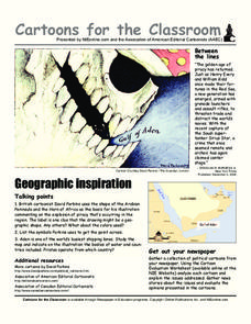
Cartoons for the Classroom: Geographic Inspiration
A wonderfully graphic cartoon entices learners to read more about issues near the Arabian Peninsula. They will use the provided cartoon and critical thinking question to practice building their analytical and critical thinking skills....
Curated OER
The Ancient Civilization of Mali
Students explore the ancient civilization of Mali and examine various historical and cultural aspects of the civilization. In this ancient civilization of Mali lesson, students examine trade with respect to geographic locations, discover...
University of California
Decolonization
The ripple effect from one small event can impact many others. Young historians research the ripple effect World War II had on decolonization in the second installment of an eight-part series. Through primary and secondary documents as...
C-SPAN
The Electoral College and the Constitution
What is the purpose of the Electoral College? Is it antiquated, or does it have a place in today's political climate? High schoolers view a series of video clips as they analyze the parts of the United States Constitution that address...
Other popular searches
- Wwi Political Map
- Maps of Europe Political
- Physical and Political Maps
- Canada Political Map
- Americas Political Map
- Blank Political Maps
- Political Map of Africa
- United Kingdom Political Map
- Europe Political Map
- Physical & Political Maps
- Mexico Political Map
- State Political Maps


