Teach Engineering
Projections and Coordinates: Turning a 3D Earth into Flatlands
Introduce your class to map projections and coordinates, the basics for the work done in a GIS, with an activity that uses Google Earth to challenge learners to think about the earth's shape.
Richmond Community Schools
Map Skills
Young geographers will need to use a variety of map skills to complete the tasks required on this learning exercise. Examples of activities include using references to label a map of Mexico, identify Canadian territories and European...
Owl Teacher
Introduction to World of Geography Test
Assess your learners on the five themes of geography and the most important key terms and concepts from an introductory geography unit. Here you'll find an assessment with 15 fill-in-the-blank and 14 multiple-choice questions, sections...
Curated OER
Map Keys
In this geography instructional activity, students identify who a cartographer is and what they do specifically. They study an outline map of a fictitious island and then, respond to the three questions that follow. Finally, students add...
Curated OER
BOLTSS Map
In this geography instructional activity, students identify the six features always used on maps. They identify each of these features by the acronym BOLTSS. Students examine the Melbourne Cricket Ground shown and respond to the 4...
K-State Research and Extensions
Water
How are maps like fish? They both have scales. The chapter includes six different activities at three different levels. Scholars complete activities using natural resources, learn how to read a map, see how to make a compass rosette,...
Balanced Assessment
School Zone
Find the right house within walking distance from school. The short assessment has pupils determine the houses that are a given maximum distance from a school. Individuals then determine the shortest and longest walks from the homes that...
Balanced Assessment
Ford and Ferrari
Which is faster, a Ford or a Ferrari? The short assessment has pupils analyze graphs to determine the rates of change between the two. Individuals interpret the rates of change within the context of speeds of the cars and develop a map...
Geophysical Institute
Latitude and Longitude with Google Earth
Travel the world from the comfort of your classroom with a lesson that features Google Earth. High schoolers follow a series of steps to locate places all over the earth with sets of coordinates. Additionally, they measure the distance...
Curated OER
Ecosystem Concept Map
How do ecosystems change? How do organisms keep their ecosystem going? Learners use a word bank to fill in 12 blanks that describe the functionality of ecosystems.
Curated OER
Choropleth Mapping Skills
In this geography activity, students identify and describe how to apply choropleth mapping skills. They examine the map given and convert it into a choropleth map through coloring. Then students use those colors to shade in their key and...
MENSA Education & Research Foundation
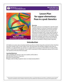
Peas in a Pod: Genetics
Can peas have grandparents? Learn about inherited traits and heredity with a set of activities focused on Mendelian genetics. As your class learns about the process of passing traits along in Punnett squares, they take on the role of...
Core Knowledge Foundation
Columbus Sailed the Ocean Blue
Young adventurers embark on a journey, setting sail along the blue ocean with Christopher Columbus. Teachers will find that this unit makes their lesson planning smooth sailing!
Mark Twain Media
Understanding Informational Text Features
Everything you need to know about informational text features can be found in this resource. Recognizing these types of text features and how they are used in text allows readers to better understand information. Teachers can use this as...
It's About Time
How Do Plate Tectonics and Ocean Currents Affect Global Climate?
What do plate tectonics and ocean currents have to do with global climate? This fourth installment in a six-part series focuses on how plate tectonics and ocean currents affect global climate, both now and in the past, outlines an...
Concord Consortium
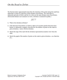
On the Road to Zirbet
The road to a greater knowledge of functions lies in the informative resource. Young mathematicians first graph a square root function in a short performance task. They then use given descriptions of towns and the key features of the...
Curated OER
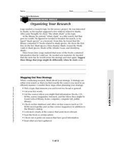
Organizing your Research
In this research learning exercise, students read about how to organize themselves when doing research. They read about a student who had a topic to research but had difficulty coming up with books about his topic. Students suggest ways...
Concord Consortium
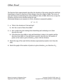
Other Road
Take the road to a greater knowledge of functions. Young mathematicians graph an absolute value function representing a road connecting several towns. Given a description, they identify the locations of the towns on the graph.
Curated OER
Third Grade Language Practice
In this grade 3 language practice worksheet, 3rd graders complete a total of 24 multiple choice questions based on a variety of grade 3 language concepts. An answer key is included.
Eastconn
Learning to Analyze Political Cartoons with Lincoln as a Case Study
Discover the five main elements political cartoonists use—symbolism, captioning and labels, analogy, irony, and exaggeration—to convey their point of view.


