Curated OER
How Do Artists Effectively Relate Historic Events?
Students explore African American migration. In this black culture and history activity, students use a map to identify northern and southern states in which African Americans lived in the 1900s. Students observe and describe objects and...
Curated OER
Identify Base Words and Suffixes to Read Multisyllabic Words #1
Show your scholars how adding an affix changes the entire meaning of a word; they focus on the suffix -able. You'll find a complete script here, but if you don't want to read this verbatim, use it simply as an outline. Learners...
Scholastic
Hill of Fire Teaching Plan
Some books are perfect for drawing connections between multiple subjects. The book Hill of Fire becomes the hub for three very different, yet related activity ideas. First the class hones their oral language skills by creating an...
National Wildlife Federation
Massive Migrations
Turn your students into flocks of migratory birds for this fun lesson on animal migration. Prior to the activity, the teacher creates four different migration routes in the classroom or any available open space, labeling nesting...
Peace Corps
Community
What is a community? Find out with a lesson that sheds light onto the different types of communities—school, local, and global. Scholars read informational text detailing the life of a young girl from Cape Verde and take part in a...
EngageNY
Which Real Number Functions Define a Linear Transformation?
Not all linear functions are linear transformations, only those that go through the origin. The third lesson in the 32-part unit proves that linear transformations are of the form f(x) = ax. The lesson plan takes another look at examples...
Teaching Adapted PE
Locomotor and Object Control Stations
Develop children's basic locomotor and object control skills with an invigorating Adaptive PE instructional activity. A series of four, timed stations engaged the class in playing a game of Twister, walking on...
NOAA
Fishy Deep-sea Designs!
Oceans represent more than 80 percent of all habitats, yet we know less about them than most other habitats on the planet. The instructor introduces the epipelagic, mesopelagic, bathypelagic, twilight, and midnight zones in the ocean....
Workforce Solutions
Workforce Solutions K-1 Lessons
Three lessons and one at-home connection explore 12 professions. In the first lesson, scholars examine an online map that displays all 12 careers alongside a video. Lesson two challenges class members to choose two of those careers to...
Curated OER
Burt County, NE, Soil Survey
Students identify the soil types and textures, and locate the waterways in or near the towns of Lyons and Decatur, Nebraska. They analyze soil profile maps, and answer conclusion questions.
Curated OER
Sorting the Loyalist Documents
Students organize the Canadian Loyalist primary source documents and add more information to their primary source document concept maps.
Curated OER
Navigating Your Community
Learners draw a map from memory describing the route between their classroom and the gym including a legend, a compass rose, a map scale, symbols, and a landmark at every change of direction. They then retrace their steps in their maps...
Curated OER
Equator, North Pole, and South Pole
Students identify the Equator, North Pole, and South Pole on the globe. In this map skills lesson, students use a globe marker to locate specific locations on the globe. Students find where they live in relation to the Equator.
Curated OER
Home on the Range
Young scholars use maps and mathematics to determine the appropriate panther population in a given area. In this Florida ecology lesson, students research the area requirements of male and female panther and use a map to help calculate...
Curated OER
How Does Kansas Measure Up?
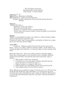
Students identify the five main crops of Kansas and crops that are produced in other states. The categorize the types of fruits and seeds of each plant and measure each to compare the length of each.
Curated OER
The Evening News - Rainforest Rescue
Fifth graders prepare a television briefing reflecting on their experiences in an earlier lesson in which they simulated surviving a crash into the Amazon and using maps to achieve rescue. They develop and present a summary of their...
Curated OER
Using Story Structure to Enhance Comprehension
In these story structure worksheets, learners review story structure and learn how to use story maps to help with their reading comprehension. Students review an example story map and then study three different graphic organizer versions...
Curated OER
Zoobilation
Students research and use their findings to design a PowerPoint presentation and zoo-type habitat with the correct ecosystem for their animal group using a variety of materials such as cardboard boxes, aquariums etc.
Curated OER
Knowing Where You Are
Learners work together to research the names of places in their state. They divide up their state so that each group can research a different section and complete a chart of the different names. They create a key for the map to explain...
Curated OER
Weather... Or Not
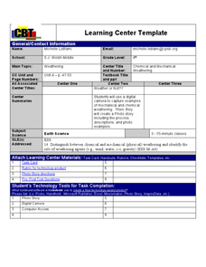
Learners observe and discuss the local weather patterns, researching cloud types and weather patterns for cities on the same latitude on the Internet. They record the data for 6-8 weeks on a graph, and make weather predictions for their...
Curated OER
Dino Detectives
As students examine maps of Utah, 4th graders search for clues about what prehistoric life was like in Utah.
Curated OER
Breads Around the World
Pupils read about bread. For this lesson studying bread, students read about the history of bread and it's significance around the world. Pupils identify the three main crops used to make bread and ten common types of bread from...
Curated OER
Mother's Day Flowers
Students complete a circle map describing why they love their mom and use a flower template to type the ways. Then they insert a digital picture into the center of the flower. The flowers are then printed out and given to their mothers...
Curated OER
Natural History of Costa Rica
Students use outline maps to become acquainted with Costa Rica. They see how it was formed and how its origin has created very diverse environments. Students then use atlases and compare their physical maps with maps of climate and the...
Other popular searches
- Different Types of Maps
- Reviewing Types of Maps
- Types of Maps Grids
- Types of Maps Worksheets
- 10 Types of Maps
- Three Types of Maps
- 2 Types of Maps
- Types of Maps Australia
- Types of Maps "Australia
- Types of Maps "Australia"
- Maps Types Key Symbols


