abcteach
Street Mapping
What's around the block? Or down the street? Ask your pupils to tap into their map skills by drafting the area around their home and school.
Curated OER
Scale Skills
In this mapping skills worksheet, students read an excerpt that describes three different types of scales and how to calculate distance on a map. They respond to two short answer questions using the map provided on the sheet and to...
Corbett Maths
Enlargements with Fractional Scale Factors
Enlargements make it bigger, right? A video shows viewers how to perform a basic dilation with a fractional scale factor. They learn how to use the scale factor to find the location of the transformed vertex by multiplying the horizontal...
University of Nottingham
Drawing to Scale: A Garden
See how design and geometry go hand in hand. The activity asks learners to use geometry to design a backyard garden given dimensions of each feature. Scholars work with ratios and scale to develop an accurate scale drawing that includes...
Richmond Community Schools
Map Skills
Young geographers will need to use a variety of map skills to complete the tasks required on this worksheet. Examples of activities include using references to label a map of Mexico, identify Canadian territories and European...
Curated OER
How To Read A Map
In this map skills worksheet, students view a map and answer five short answer questions by using the map key as a...
Owl Teacher
Introduction to World of Geography Test
Assess your learners on the five themes of geography and the most important key terms and concepts from an introductory geography unit. Here you'll find an assessment with 15 fill-in-the-blank and 14 multiple-choice questions, sections...
Mathematics Assessment Project
Geometry
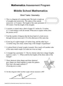
Help learners find joy in facing mathematical challenges. The questions posed on this worksheet encourage young mathematicians to utilize skills learned throughout a geometry unit, and to apply themselves and persevere through...
Curated OER
BOLTSS Map
In this geography worksheet, learners identify the six features always used on maps. They identify each of these features by the acronym BOLTSS. Students examine the Melbourne Cricket Ground shown and respond to the 4 questions that follow.
Curated OER
Ancient Egypt Geography
Nine questions to answer and one map to read. Seventh graders will use the map of Ancient Egypt to practice map reading skills and build a visual image of Ancient Geography.
Curated OER
U.S. Political Map
In this political map worksheet, students use the map of the United States and the 7 cities to measure the straight-line distance between the cities. Students add the total number of miles traveled and write their answers in the spaces.
Curated OER
Maps- Looking at Map Scales
In this map scale worksheet, students examine how to convert measurements on a map. They read 5 examples before completing 8 multi-step conversion problems. They insert the answers in an online version of the worksheet to determine if...
Kentucky Educational Television
The Road to Proportional Reasoning
Just how big would it really be? Young mathematicians determine if different toys are proportional and if their scale is accurate. They solve problems relating scale along with volume and surface area using manipulatives. The...
Curated OER
Maps Reinforcement
In this map worksheet, students complete 6 multiple choice questions and 5 short answer questions about 3 different map figures.
Curated OER
Scale Drawing
In this measuring lengths worksheet, students determine which units to use when measuring lengths, estimating lengths, and the errors made when measuring, Students estimate the lengths of each of the lines illustrate to the nearest unit....
K-State Research and Extensions
Water
How are maps like fish? They both have scales. The chapter includes six different activities at three different levels. Scholars complete activities using natural resources, learn how to read a map, see how to make a compass rosette,...
Mathematics Assessment Project
Photographs
Picture your pupils using this assessment task. Class members must first determine the measurements of smaller copies of photographs placed next to the original. They then determine the dimensions of the entire sheet of photographs.
WindWise Education
What Factors Influence Offshore Wind?
What is that out in the water on the horizon? Teams work together to study the coastline using maps to determine the best and worst locations to place an offshore wind farm. The teams then build a scale model wind farm to see what it...
Curated OER
Map Analysis Worksheet
In this map analysis activity, students decipher what type of map they are using based on a complete list of criteria. Students then answer multiple questions based on their discoveries.
Curated OER
The Roman Empire-Map Activity
In this Roman Empire learning exercise, students complete a map activity in which they label and color civilizations, countries and physical features as instructed. There are no maps included.
Curated OER
Complex Analysis: Linear Transformations, Inversion Mappings
In this transformation activity, students identify a series of transformations and sketch them. They use inversion mapping to establish a one-to-one correspondence between nonzero points. This four-page activity contains approximately...
Curated OER
Scaling in Maps
For this recognizing map scale ratios worksheet, students use ratios and centimeter measurements to calculate the distances in reality. Students solve 8 problems.
Curated OER
Topographic Maps
In this topographic map worksheet, students learn how to read a topographic map and create a topographic map of their own using clay or Play-Doh. Students include contour lines by layering the clay. Students answer 6 questions about...
Curated OER
Scale Drawing
In this scale drawing worksheet, 10th graders solve 10 different word problems that include various types of scale drawings in each. First, they determine the length of a highway on a map. Then, students determine the dimensions of a...


