Curated OER
Time Zones
Students solve time zone problems and chart travel around the world. In this time zone lesson, students learn about the history of time zones and view a time zone map. Students use the time zone map to solve time zone problems. ...
Curated OER
Time Zones
Students study the reason why time zones exist and how they are established. They predict time zones for different places on Earth.
Curated OER
Time Around the World
Seventh graders investigate the characteristics of a time zone map. They read and interpret time zone maps. Students compare the time in various time zones. Students solve time zone problems.
Curated OER
Time Zones
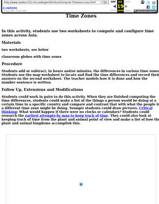
Fifth graders locate different time zones. In this time zones activity, 5th graders label the different time zones. Students research the different ways man has kept time throughout history. Students also compute the differences in time...
Curated OER
Time Zones
Third graders have a greater understanding of time zones, explain the basic history and purpose in the creation of time zones, and use time zone maps to calculate the time/day in a certain area.
Curated OER
Understanding Time Zones
Students investigate the times zones around the world. They discuss situations when it is important to know the time in different parts of the world and how to find it.
Curated OER
Time Zones and Migration Patterns of the Leatherback Sea Turtle
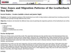
Learners identify the different time zones by plotting the migration patterns of the leatherback sea turtles. They discover that traveling around the worlds includes passage through different time zones.
NOAA
A Watery World
With about 70% of the earth's surface covered in oceans, it's fair to say that we live in a very wet world. Young scientists gain a better appreciation of this fact as they use maps to identify the world's ocean basins in the first...
Curated OER
Understanding Latitude, Longitude, and Time Zones
Students take an imaginary world tour by locating cities with latitude and longitude. They plan an itinerary and calculate the time zones from which they would call home. Then they construct word problems involving travel across time zones.
Curated OER
It's About Time: Olympics, Winter Sports, Math, Media, Time Zones
Pupils use the Internet to determine broadcast times for the Winter Olympic Games snowboarding competitions. In determining these times, they need to consider time zones throughout the world.
Curated OER
Time and Time Again
Students analyze the effects of time zone differences on how we function as a global community, focusing particularly on the turn of the millennium as a way for students to calculate time zone differences.
Curated OER
The Geography of the United States
Full of bright maps and interesting information, this presentation details U.S. Geography. Slides include basic facts about size, regions, topography, and demographics, as well as fascinating trivia about the United States, including...
Curated OER
Math with Maps and Globes
Students round out their math skills with these ‘round the world' ideas. In this math and geography activity, students try out time zone sticks, a polar race, and tic-tac-globe to engage them in learning more about globes and the...
Curated OER
Lesson Design Archaeology- World Map
Students practice locating positions on the world map. In this map skills lesson, students explore the world map and items such as the compass rose, Equator, mountains, cities, etc. The students practice locating positions on the world...
Curated OER
Geomnemonics: Facilitating the Teaching of Social Studies Content with Geography Skills
Young scholars explore how to draw a world map by hand and how to locate countries.
Curated OER
Tools of the Trade: The Use of Geographic Tools
Students examine the tools of demographic analysis and apply them to real-world situations. They analyze maps, define terminology, and write an information paper for the appropriate government agency to recommend an action or policy change.
Curated OER
Mapping China
Students identify cities in China on a map. In this map skills lesson plan, students locate the continent of Asia and the country of China. Students use a blank map to label China and bordering countries.
Curated OER
World Climate Growing Zones
Students create a map showing where crops would be grown around the world. In this crops lesson plan, students show how the world climate would produce different parts of the world at different times. Students fill out worksheets.
Curated OER
Where in the Latitude Are You? A Longitude Here.
Students distinguish between latitude and longitude on the map. In this mapping lesson, students participate in mapping skills to recognize spatial relationships, and where to find natural resources on the map. Students create their own...
Curated OER
Maps, Charts, and Graphs
Students define key geographic terms and track a hurricane on a map. They examine various types of maps and find locations on them,including rivers, cities and mountains.
Curated OER
'Tis a Long, Long Way to Tipperary!
Learners practice finding the location of cities across the world by using an interactive Web site, and figure out the world's time and the value of time zones the world over.
Curated OER
Latitude and Longitude
Students find latitude and longitude on a map or atlas. They create maps with a cruise route. They practice plotting locations given latitiude and longitude.
Curated OER
Canada's Geographic Position
Ninth graders investigate the characteristics of the geographic position of Quebec and Canada in the World. They study Canada's land and water boundaries, surface area and time zones.
Curated OER
Lesson 1 Activity 1: Tools of the Ancients
Students examine how Christopher Columbus determined his latitude.


