Curated OER
Rock On!
After five class sessions, young scientists will be able to identify common rock types: igneous, sedimentary, and metamorphic. This plan involves hands-on activities, includes various handouts and worksheets, and requires there to be...
Curated OER
Colonial Vacation Planner
Looking for a good lesson plan on the Colonial Period for your upper-elementary class? Then, this lesson plan is for you! They use website designs, U.S. travel publications, and maps to plan a family vacation to states which were part of...
Curated OER
Neither Wind Nor Rain
Here is another in the interesting series of lessons that use the special State Quarters as a learning tool. This one uses the North Dakota State Quarter. During this lesson, your class learns about the different patterns of erosion, and...
Curated OER
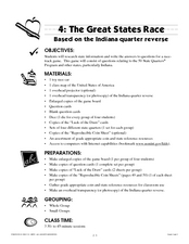
The Great States Race
Here is another in the interesting series of lessons that use the special State Quarters as a learning tool. This one uses the Indiana State Quarter. During this lesson, utilize a brilliantly-designed board game that is embedded in the...
Curated OER
El Mundo Hispano
Colorful maps are clearly labeled in this PowerPoint to show viewers where different Hispanic countries are located within Central and South America. Each country is listed on its own slide with a title, the capital, close-up map, flag,...
Angel Island Immigration Station Foundation
Where Is Angel Island? An Introductory Geography Lesson
Prepare young historians for a study of Angel Island Immigration Station with a lesson examining primary and secondary source materials, maps, and websites. Using what they have learned, individuals create a map of Angel Island, labeling...
DocsTeach
Around the World with First Lady Pat Nixon
Travel the world with the First Lady! Academics study images from Pat Nixon's travels as First Lady to discover her role in Richard Nixon's presidency. Historians match images to world locations, complete a worksheet, and participate in...
National Endowment for the Humanities
Hopi Place Names
What's in a name? Historians consider the question as they examine places important to the Hopi people and the meanings of their place names. Included worksheets include maps and charts to help class members examine the geography of Hopi...
Museum of Science
Make a Map
It's important to know the final destination. Scholars first measure distances in a region of interest using a standard measuring device or by counting steps. They then use an appropriate scale and graph paper to create a map of the...
University of Wisconsin
We're Off to India!
Pack your bags and set off to the wonderful country of India in a multi-day cultural unit. The lesson is a 17-day series focusing on literature, music, art, geography, and the culture of India. Scholars complete several activities,...
Arcademics
Penguin Hop
It's a race to learn the state capitals. Using a multi-player video game, participants hop from iceberg to iceberg as penguins in response to questions about state capitals. The real-time practice lets both teacher and learner assess...
Arcademics
Country Toad
Hop from country to country to practice knowledge of international capitals using an interactive video game. Pupils take control of frog avatars and direct them to leap from the name of a capital to its home country. The video game...
Arcademics
Toad Hop
Hop-scotch your way across the world to help improve class members' skill and accuracy in identifying capital cities. By using a frog avatar, learners leap to the correct country for each capital city as it flashes up on the screen....
Arcademics
Capital Penguin
Hop across the country like a penguin from ice floe to ice floe using an interactive video game. Acting as a penguin, learners match capitals to their states. Game features allow teachers to set up competitions and check learning progress.
National Wildlife Federation
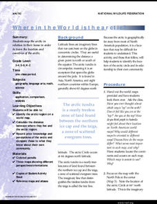
Where In the World Is the Arctic?
Exactly how far away is the Arctic? Learners use maps to orient themselves to their locations on the globe. They then make calculations to describe how their location relates to the location of the Arctic regions.
Scholastic
Perfect Postcards: California
It's time to hear about some adventures in travel! The Transcontinental Railroad changed life and travel in the United States during the 1800s. Practicing online research skills, pupils discover the features they would like to visit on...
Pace University
Urban Communities
Urban communities are the focus of a series of lessons created to meet specific needs using differentiated instruction. A pre-assessment designates scholars into three groups based on their ability level. Small groups take part in...
Center for Advanced Research on Language Acquisition (CARLA)
Bringing the Biodiversity of Ecuador to Spanish Immersion Classrooms
Designed for the Spanish Immersion classroom, scholars take a look at biodiversity and Ecuador; all the while, practicing their Spanish with a focus on verbs. In small groups, learners examine photographs of the different climate regions...
Core Knowledge Foundation
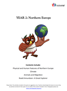
Year 2: Northern Europe
How is life in Northern Europe different from other areas of the world? Historians journey through the various regions of Northern Europe discovering what type of climate, animals, and lifestyles exist in that section of the world. They...
Seterra
Northern Europe: Countries - Map Quiz Game
Remembering geography is a tiring and tedious task to many scholars. Change it up by assigning the map quiz game. Elementary and middle schoolers alike test their knowledge and compete with the clock to match as many countries as...
Geography for Geographers
Five Themes of Iceland
How do the five themes of geography relate to the country of Iceland? Pupils learn about everything from the differences between relative and absolute location to how humans both adapt and change the environment. The presentation...
BrainPOP
Latitude and Longitude Differentiated Lesson Plan
Scholars warm-up their map skills with a discussion using location words to describe familiar places. An engaging video informs class members about latitude and longitude. Three leveled activities extend the learning experience for...
NET Foundation for Television
1850-1874 Railroads and Settlement
Have you ever wondered how your town was placed where it is? Scholars research the impact the advancement of the railroad due to the passage of the Kansas-Nebraska Act had on the formation of civilization in the Great Plains. Map...
NET Foundation for Television
1850-1874 Beef Moves to Nebraska
Just how long was the Long Drive? Learners investigate the movement of cattle in the Great Plains during the mid-1800s. They incorporate photographic, newspaper, video, and primary source evidence into their posters, artwork, and written...


