Space Awareness
The Sun Compass of the Vikings
Evidence shows the Vikings likely navigated by using a simple sundial to find their course. Videos, a short story, and discussion help bring this time period to life as they study European history with a hands-on experiment. Scholars...
California Academy of Science
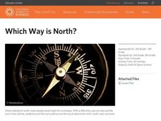
Which Way is North?
Who needs a compass to find cardinal directions? Just place a stick in the ground and record the movement of its shadow over the course of a day. Then, measure the shadow lengths in order to determine a north-south line. A simple...
Compton Unified School District
How Can We Locate Places?
How can we locate places? Maps, of course! Expose second graders to the tools available in maps and discuss how these tools can help people find locations. Students also look at communities, including what makes a community and the...
Curated OER
Orienteering 2
Students are shown the basics of map and compass work. They name the parts of a compass and comprehend the function of each part. Students define paces and tallies and use them in a real world situation. They use a map and compass to...
Curated OER
Orienteering I
Students are introduced to compass work. They name the parts of a compass. Students describe how the parts of a compass are used. They are shown the proper way to hold a compass. Students are shown that-a-way arrow and its purpose.
Mathematics Vision Project
Congruence, Construction and Proof
Learn about constructing figures, proofs, and transformations. The seventh unit in a course of nine makes the connections between geometric constructions, congruence, and proofs. Scholars learn to construct special quadrilaterals,...
Skyscraper Museum
Changes in a City Over Time
Investigate the growth and development of New York City with the final lesson in this four-part series on skyscrapers. Learners first explore the concept of urban growth by looking closely at a series of three paintings made of Wall...
Curated OER
Orienteering II
Students name the parts of a compass and comprehend the function of each part. They define paces and tallies and use them in a real world situation. Students are shown the proper use of radio terminology. They use a map and compass to...
Curated OER
Native American Homelands
Students discuss the Navajo, Sioux, and Iroquois tribes, noting their distinctive characteristics. They trace the homeland of each of the tribes on maps and create map keys. Students explain how they developed their map keys.
Curated OER
CHARTING A COURSE
Young scholars model how a gyroscope works with string, an old phonograph record and crayon.
Curated OER
The Evolution of Technology
Ninth graders explore the evolution of technology. They discuss how technology has affected their daily lives and how it has changed throughout the course of history. They discuss what invention has most affected the world.
Curated OER
Space Science:Wherever You Go, There You Are
Students explore navigation principles by observing, measuring, and interpreting data to determine locations. Using a compass, compass rose, and a transit, they plot courses and discover the workings of the Global Positioning System...
Curated OER
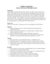
Tomb Guardians
Students practice using compasses to find cardinal directions in this cross-curricular instructional activity about the Chinese art of tomb sculptures. The instructional activity also includes a creative instructional activity extension.
Curated OER
A Sense of Location: The Mental Map
Students consider the ways a mental maps of geographic landmarks can help migrating animals stay on the correct course.
Curated OER
Orienteering: Map Skills
Young scholars discover orienteering. In this orienteering instructional activity, students search for six specific landmarks. Young scholars brainstorm how maps and landmarks are helpful.


