Science 4 Inquiry
Edible Plate Tectonics
Many people think they can't observe plate tectonics, but thanks to GPS, we know that Australia moves at a rate of 2.7 inches per year, North America at 1 inches per year, and the Pacific plate at more than 3 inches per year! Scholars...
NOAA
Plate Tectonics Interactive
Here is a plate tectonics interactive that will really move your class! The first of a 13-part series introduces young geologists to the fundamental concepts and vocabulary they need to understand the interactions between...
Curated OER
Plate Tectonics
Help young scientists piece together the theory of plate tectonics with this comprehensive collection of materials. Whether your are looking for worksheets, hands-on activities, or assessments, this resource has everything...
Oregon State
World Map of Plate Boundaries
Young geologists piece together the puzzle of plate tectonics in an earth science lesson. Given a physical map of the world, they search for land formations that indicate the location of different types of plate boundaries.
NOAA
The Biggest Plates on Earth
The deepest part of the ocean is the Marianas trench where two tectonic plates meet. Scholars explore plate tectonics and their boundary types by completing hands-on activities throughout the lesson. Specific areas, such as the Galapagos...
Curated OER
Plate Tectonics: First Grade Lesson Plans and Activities
A set of first grade geology lessons focuses on plate tectonics and movement of plate boundaries. During the pre-lab, learners experience three types of plate movement through a kinesthetic demonstration. The lab...
Curated OER
Plate Tectonics: Fifth Grade Lesson Plans and Activities
Fifth graders continue their investigation of the plate tectonics cycle with an exploration of the movement of Earth's crust. During the lab, young geologists conduct an experiment to discover the result of different types of...
Curated OER
Plate Tectonics: Third Grade Lesson Plans and Activities
Third graders examine plate movements and boundaries with a lab that demonstrates how volcanoes and earthquakes are formed. It presents different types of stresses an object can withstand through a hands-on...
Curated OER
Plate Tectonics: Sixth Grade Lesson Plans and Activities
Here is a set of pre-lab, lab, and post-lab lesson plans on plate tectonics. After completing the previous labs on volcanoes and earthquakes, sixth graders use the gained knowledge to explore plate boundaries and the movement of...
Columbus City Schools
Geological Effects of Plate Tectonics
Don't get your classes all shook up about plate movement, instead use a thorough unit that guides learners to an understanding of plate tectonics. The lessons incorporate a study of the types of plate boundaries and their effects on the...
Curated OER
Teaching About Plate Tectonics and Faulting Using Foam Models
Young scientists learn about plate tectonics and the three different types of faults (normal, reverse, and strike-slip) using foam models. The activity also covers common types of locations where these faults are found.
Scholastic
Lesson Four: The Earth, Layers of Earth
Get your hands dirty with a set of earth science activities! Class members delve into a hard-boiled egg to find the similarities to the earth's layers, create a papier-mâché model of the earth, craft a simulation of the earth's...
Curated OER
Plate Tectonics: Fourth Grade Lesson Plans and Activities
The pre-lab portion of the lesson introduces emerging geologists to the various layers that make up Earth. After completing a sheet on the identification of the layers, class members simulate plate boundaries and their...
STEM for Teachers
Tsunami!
How does the depth of an ocean affect the speed of a tsunami's waves? Use Jell-o, graham crackers, and marshmallows to model the effects of an underwater earthquake and its resulting tsunami. The activity includes hands-on activities,...
Center for Math and Science Education
Plate Tectonic Globe
During your Earth systems unit, you could have junior geologists cut out and create a small globe depicting the tectonic plates. You may want to do this all together, step by step as a class because it would be easy to cut all of the...
NorthEast Ohio Geoscience Education Outreach
Investigation of Plate Boundaries
Demonstrate the movement of lithospheric plates due to convection in Earth's mantle. Learners then model the movements that occur along plate boundaries using colored clay.
Howard Hughes Medical Institute
EarthViewer
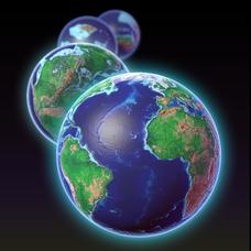
Can you imagine Washington DC and London as close neighbors occupying the same continent? Learners will be fascinated as they step back in time and discover the evolution of the earth's continents and oceans from 4.5 billion...
K-State Research and Extensions
The Crusty Earth
Geology rocks — literally! A geology chapter offers eleven activities at four different levels. Scholars enjoy completing hands-on experiments before applying critical thinking skills following a share, process, generalize, apply,...
NOAA
Into the Deep
Take young scientists into the depths of the world's ocean with the second lesson of this three-part earth science series. After first drawing pictures representing how they imagine the bottom of the ocean to appear, young scholars...
Curated OER
Volcanoes: Sixth Grade Lesson Plans and Activities
Bring a set of pre-lab, lab, and post-lab lesson plans on volcanoes to your earth science unit. Sixth graders explore the three types of volcanoes found on Earth, plot the specific locations of these volcanoes on a map, and...
Curated OER
Earthquakes: Sixth Grade Lesson Plans and Activities
Young seismologists learn more about plate tectonics with a set of pre-lab, lab, and post-lab lessons plans on earthquakes. After exploring how waves travel through various materials, sixth graders record their observations and...
Channel Islands Film
Island Rotation: Lesson Plan 1
How do scientists provide evidence to support the theories they put forth? What clues do they put together to create these theories? After watching West of the West's documentary Island Rotation class members engage in a series of...
Science Matters
Up and Down Fault Blocks
The Sierra Mountains in Nevada and the Tetons in Wyoming originally formed as fault block mountains. In order to visualize these fault blocks, pupils use construction paper to create layers of earth. They cut the paper models and form...
NOAA
Subduction Zones
Sink into an interactive learning experience about subduction zones! Junior oceanographers examine the earth-shaking and earth-making effects of subduction in the fourth installment in a 13-part series. Hands-on activities include...


