Curated OER
Use Google Maps to Teach Math
Capture the engagement of young mathematicians with this upper-elementary math lesson on measuring time and distance. Using Google Maps, students first measure and compare the distance and time it takes to travel between different...
CK-12 Foundation
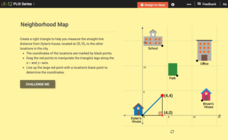
Pythagorean Theorem to Determine Distance: Neighborhood Map
Find the distance between various locations in a neighborhood. Scholars use the interactive to find distances between locations on a map. The map is overlaid onto a grid to provide coordinates for each location, and pupils apply...
CK-12 Foundation
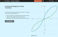
Inverses by Mapping: Inverse Functions
Map your way to successfully understanding inverse functions. Pupils use an interactive map to investigate how changes in the graph of a function affect the graph of its inverse. The results of the activity lead to the conclusion that...
CK-12 Foundation
Whole Number Multiplication: Multiplication Map
How many miles did a car travel if it traveled at 55mph for three hours? What are the factors for this multiplication sentence? These are the questions young mathematicians must solve using a multiplication map.
Curated OER
Grid Frame Mapping
Students map and describe small area of the schoolyard and discuss habitats.
Curated OER
Mystery Map
Students compare and contrast varying approaches to present information, as they create a workable study guide. They create a Mystery Map with hidden words, facts, or hints to find treasures. Afterward, they interact and discuss...
Annenberg Foundation
Geometry 3D Shapes: Surface Area and Volume
Whether you wrap it or fill it, you're using geometric concepts. Classmates use an interactive approach to learn how to find volume and surface area of cylinders and prisms in the second lesson in a five-part series. The online lesson...
Teach Engineering
Searching for Bigfoot and Others Like Him
Individuals create a GIS data layer in Google Earth that displays information about where one might find seven different cryptids. The class members research to find data on cryptid sightings they can include in their data...
Annenberg Foundation
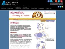
Geometry 3D Shapes: 3D Shapes
Explore vocabulary related to three-dimensional shapes. An instructional website describes the characteristics of different geometric solids. Learners can use an interactive component to view nets, faces, vertices, and edges of common...
CK-12 Foundation
Intersecting and Parallel Lines
Sometimes line segments just refuse to meet. Young mathematicians connect houses on an interactive map using line segments. They must then determine whether these line segment pairs are intersecting or parallel.
CK-12 Foundation
Identify Line Types: Intersecting and Parallel Lines
Navigate your way through a lesson on types of lines. Individuals drag line segments to illustrate paths between pairs of houses on an interactive map. They determine if these line segment pairs are intersecting or
parallel.
CK-12 Foundation
Regular and Irregular Polygons: Polygon States
Colorado would probably object if Wyoming enlarged its borders. Scholars use an interactive map to change the borders of U.S. states to see how angles change. They then answer questions about regular and irregular polygons.
CK-12 Foundation
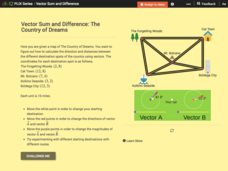
Vector Sum and Difference: The Country of Dreams
Find your way around using vectors. Scholars use an interactive to learn about vector addition. They answer a set of questions about modeling a route on a map using vectors.
Council for Economic Education
Banks and Credit Unions (Part 1)
Imagine you have money you want to save ... where do you put it? Pupils investigate the similarities and differences of banks and credit unions as they determine where exactly to place their hard-earned money. Through a WebQuest,...
CK-12 Foundation
Midpoint and Segment Bisectors: Midpoint Map
Discover how to find a midpoint with a conceptual exploration. Scholars manipulate a point to determine the location of a midpoint on a straight line distance between two locations. Later questions extend to determine the...
CK-12 Foundation
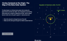
Circles Centered at the Origin: The Map of the Beta Solar System
Calculate galactic orbits in a far-out resource. Pupils drag a point on a circle to graph the orbit of a fictional planet. Using the equation, they find points through which the orbit passes. To finish the simulation, users determine the...
Annenberg Foundation
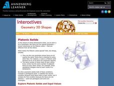
Geometry 3D Shapes: Platonic Solids
From polyhedrons to platonic solids, here is a lesson that will have your classes talking! As an introduction to platonic solids, scholars cut and fold nets to create the three-dimensional solids. They use an interactive component to...
Curated OER
CEENBoT Takes a Dive
Students create a map to scale using technology. In this algebra instructional activity, students navigate through a shipwreck to perform rescues. They use he CEENBoT program to perform the different tasks.
EngageNY
Definition of Reflection and Basic Properties
Discover the results of reflecting an image. Learners use transparency paper to manipulate an image using a reflection in this fourth lesson plan of 18. They finish by reflecting various images across both vertical and horizontal lines.
Curated OER
Make Your own Treasure Hunt!
Young scholars participate in a variety of treasure hunts to promote critical thinking skills. In these problem solving lessons, students go on a photo hunt, scavenger hunt, clue hunt, and map hunt, looking for specific treasures.
CK-12 Foundation
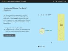
Equations of Circles: The Sea of Happiness
Map this! Help your young mathematicians draw a circular island on a map. Given specifics of the location and size of an island on a map, pupils transform a circle to meet the given requirements. They then determine the location of the...
Curated OER
A Contouring We Go
Students examine the built environment and infrastructures of their community by constructing contour equipment, using the equipment, and comparing their results to current topographical maps of the same area
CK-12 Foundation
Points in the Coordinate Plane
Map your way to success in understanding coordinate points. Individuals drag town landmarks to their appropriate locations on a coordinate plane representing a map. They answer a set of challenge questions to see if their answers are...
Curated OER
Global Warming
A series of independent learning activities teaches learners about global warming as it relates to economics and industrialization. The culminating project requires them to create a multimedia presentation identifying the problems,...

