Education.com
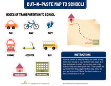
Cut-N-Paste Map to School
How do you get to school? Using the second page of the worksheet, you can draw a map of your route to school and paste on images of a scooter, bus, car, or feet.
abcteach
Street Mapping
What's around the block? Or down the street? Ask your pupils to tap into their map skills by drafting the area around their home and school.
Rainforest Alliance
Knowing the Essential Elements of a Habitat
To gain insight into the many different types of habitats, individuals must first get to know their own. Here, scholars explore their school environment, draw a map, compare and contrast their surroundings to larger ones. They then write...
Exploratorium
Measuring and Mapping the Playground
The school playground is a great place to learn about math. Pupils measure the dimensions of a playground using baby steps and individual strides. They use their measurements to create a scale drawing of the playground by applying an...
NASA
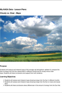
Cloudy vs. Clear - Maps
Find out the science of how clouds keep Earth cooler on hot days. Using guided discussions, investigators analyze and interpret maps of how much solar energy Earth receives at different times of the year. Participants draw conclusions...
Curated OER
Creating a Life Map
Students create their own life map in which they introduce themselves to each other by sharing what they are most proud of. They use a life map to expressive themselves creatively.
Curated OER
Isolines on a Weather Map
Ninth graders recognize isolines on a weather map and draw isolines based on temperature data on a weather map. They draw isotherms on a weather map to identify temperature patterns.
Curated OER
Map Skills
Thirds graders reinforce that a map is a drawing that shows what a place looks like from above. They use a map key and symbols to create a map of the school and its neighborhood.
Curated OER
Maps and the Pictures in Our Heads
Geographers of all ages examine different types of maps. They draw maps of their environment, utilizing both three-dimensional and picture maps. They interpret map information, noting how it can sometimes be misleading. Some good...
Curated OER
Amelia Earhart - Drawing Conclusions
Examine the life of Amelia Earhart with kids. They will read facts and view a timeline about Earhart's life. They will work in groups to read the last radio transmissions and draw conclusions about what happened in her disappearance and...
Curated OER
Draw an Inch, Walk a Mile
Students work in small groups to solve the problems presented. The main project, mapping the classroom, use these discussions to collaborate in creating a tangible demonstration of their understanding.
Public Schools of North Carolina
Democratic Republic of Congo - Map Skills
Work on your map skills with a packet of activities about the river basins in the Democratic Republic on Congo. Learners study the maps provided before answering the geography questions and writing an acrostic poem about the region.
Curated OER
The Treasure Map
Third graders problem solve using drawings and map interpretations. They preview graphs and Cartesian geometry. They follow directions on a map using a grid and compass references while simulating they are reading a pirate map.
Curated OER
2nd Grade - Act. 21: Me On the Map
Second graders read book, Me On the Map, and create map of their bedroom and of their house.
Curated OER
Handy Map
Students become familiar with the purpose of maps through a hand mapping lesson plan. In this hand mapping lesson plan, students draw their hand and use it to explain directions and labeling on a map.
Curated OER
Map Skills
Students create two types of maps. In this map skills lesson, students discuss map vocabulary and view maps of Florida. Students draw a free hand map of Florida and include major cities, bodies of water and land forms. Students work...
Curated OER
Understanding Topographic Maps
Underclassmen create a cone-shaped landform and then draw a contour map for it. Then they examine a quadrangle (which was easily located with an online search), and relate it to what they experienced. The accompanying worksheet is...
Curated OER
The Map Cartouche
Students discuss the history and purpose of cartouches. They examine examples of cartouches and design an original example with symbols of their choosing.
Beauty and Joy of Computing
Sprite Drawing and Interaction
Discover how to program objects to move on a screen. In the second lab of a five-part unit, each learner uses block instructions to program a sprite to follow their mouse (cursor). They investigate how to use these same block...
Curated OER
Geography and Culture of China
Take out a map, a paper, a ruler, and those coveted colored pencils for a lesson on Chinese culture and geography. This is a multifaceted approach to basic geography skills that incorporate story telling, class discussion, primary source...
Curated OER
Listening Comprehension: Retell Main Events of a Story
Story retell is a very important skill. Little learners use a story map and a previously heard story to walk through the retell and story sequencing process. They complete this activity as a whole class and then on their own.
Southern Nevada Regional Professional Development Program
Using Maps to Inspire Personal Narratives
A solid description of one way to teach narrative writing, this resource outlines the writing process from concept to completion. Class members create concept maps of moments in their lives and follow the writing process to publish their...
Curated OER
Exploring Countries and Cultures
Fifth graders choose a country associated with a family member and research its location, government, language, economy, history, holidays, foods, sports, and famous people. They write to inform using this data and draw a map identifying...
Curated OER
The Roman Empire-Map Activity
In this Roman Empire worksheet, students complete a map activity in which they label and color civilizations, countries and physical features as instructed. There are no maps included.


