Curated OER
What's Down There?
Investigate the coral reefs around Mokolai Island, Hawaii by researching and writing about improving the reef ecosystem. Learners map threats to the ecosystem and use the list of key words to assist in their descriptions
Curated OER
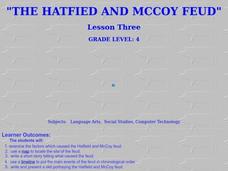
The Hatfield and McCoy Feud
Fourth graders investigate the Hatfield and McCoy feud. In this Hatfield and McCoy feud lesson, 4th graders examine factors that caused the feud. Students also locate on a map where the feud took place, make a timeline of the main events...
Annenberg Foundation
America's History in the Making: Classroom Applications One
Someone finds a time capsule 100 years from now, and it includes your family photo album. What would the photos tell that person about you and your place in history? Scholars investigate how artifacts tell stories. Using photos, maps,...
Teach Engineering
Who Can Make the Best Coordinate System?
Working with a map that does not have a coordinate system on it, small, collaborative teams must come up with a coordinate system for their map. Groups then explain their coordinate structure to the class.
NET Foundation for Television
1850-1874 Railroads and Settlement
Have you ever wondered how your town was placed where it is? Scholars research the impact the advancement of the railroad due to the passage of the Kansas-Nebraska Act had on the formation of civilization in the Great Plains. Map...
Curated OER
Map Puzzles
Students make puzzles from world maps, dramatizing how much of the globe is covered by ocean.
NET Foundation for Television
1850-1874 The Kansas-Nebraska Act
How the Kansas-Nebraska Act created Bleeding Kansas is complicated—until scholars research and examine documents from the time. After completing activities that include mapping, photo, document analysis, and discussion, learners...
Science Matters
Ring of Fire
Over a period of 35 years, earthquakes and volcanoes combined only accounted for 1.5 percent of the deaths from natural disasters in the United States. The 15th lesson in a 20-part series connects the locations of earthquakes and...
Columbus City Schools
Geological Effects of Plate Tectonics
Don't get your classes all shook up about plate movement, instead use a thorough unit that guides learners to an understanding of plate tectonics. The lessons incorporate a study of the types of plate boundaries and their effects on the...
Cornell University
Too Much of a Good Thing?
Continuing their study of beneficial insects, young entomologists discover where in the world some of these bugs are. By labeling, coloring, and using the scale on a map, pupils explore the territories and arrival of the Asian lady...
Annenberg Foundation
Contested Territories
United States expansion into Western territories impacted much more than just lines on a map. The seventh installment of a 22-part series about America's history puts scholars into the lives of those making the journey westward as well...
National Constitution Center
Explore Rights Around the World
How has the American Bill of Rights influenced the rest of the world? An interactive web activity helps individuals see the similarities between countries' bills of rights. A text-to-text tool compares the American Bill of Rights to...
Teach Engineering
Stormy Skies
Young meteorologists examine the four main types of weather fronts and how they appear on a weather map. Participants learn about the difference between the types of weather fronts along with their distinguishing features. A...
Curated OER
Earth's Water
If the majority of our planet is covered with water, why do we need to bother conserving it? With a thorough and varied investigation into the location and types of water on the earth, learners will gain an understanding of why this...
Ashbrook Center at Ashland University
The Constitutional Convention
Imagine sitting down with representatives of your school to write a new student handbook. What arguments would ensue? How would compromises be made to finish the project? Scholars research the Constitutional Convention using a directory...
Moanalua Gardens Foundation
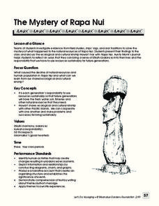
The Mystery of Rapa Nui
What caused the collapse of the environment on Rapa Nui (Easter Island)? Who constructed the Moai? What was their purpose? Class members assume the role of investigators and use evidence drawn from field studies, ships' logs, and...
101 Questions
Home Depot
Household emergencies often require supplies from a home improvement store. Pupils view a map showing a home and three different stores to determine which is the closest. Follow-up activities find close food options as well.
NET Foundation for Television
1850-1874 Homestead Act Signed: Who were the Settlers?
Life in the great, wide-open spaces of the West! Scholars analyze the reasons behind the vast movement to the Great Plains after the passing of the Kansas-Nebraska Act and the Homestead Act. Using photographic, document, map, video, and...
Big History Project
Human Migration Patterns
Humans have been on the move for millennia. Using an article from The Smithsonian, pupils chart human movement before written history on a world map. In addition, they examine the modes of transportation used by different waves of human...
Teach Engineering
Projections and Coordinates: Turning a 3D Earth into Flatlands
Introduce your class to map projections and coordinates, the basics for the work done in a GIS, with an activity that uses Google Earth to challenge learners to think about the earth's shape.
Midwest Institute for Native American Studies
Introduction to Pre-Columbian Lessons
Native peoples established civilizations all over Central and North America. Introduce native civilizations with a unit that promotes discussion, reinforces map skills, enhances reading comprehension, and exposes young historians to the...
University of California
Decolonization
The ripple effect from one small event can impact many others. Young historians research the ripple effect World War II had on decolonization in the second installment of an eight-part series. Through primary and secondary documents as...
101 Questions
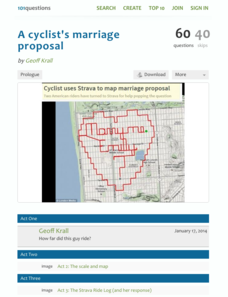
A Cyclist's Marriage Proposal
One cyclist goes to great lengths to make his proposal! Your classes must figure out just what length that is. Using a map with a bike route that spells out Marry Me, learners calculate the total distance of the ride. They base their...
National Endowment for the Humanities
Hopi Place Names
What's in a name? Historians consider the question as they examine places important to the Hopi people and the meanings of their place names. Included worksheets include maps and charts to help class members examine the geography of Hopi...


