Curated OER
Real World Investigation- Math and Geography- Elevation Changes
In this math and geography real world investigation, 6th graders plan a driving trip to a city that is located several states away from their home while recording the elevations of three cities that are included in the trip. They use...
Curated OER
European Elevation Sort
Given a prepared database of European countries, sixth graders sort the countries in ascending order by elevation and identify the five countries with the highest elevations. This cross-curricular lesson combines elements of computer...
Curated OER
Pop Art Lesson Plans
Pop art lesson plans help students understand the meaning of art and how it relates to society.
iCivics
Step 8: Talk It Up
You have 30 seconds to sell your idea ... go! Scholars master the art of the elevator pitch in the eighth step of a 10-part series. They use research, practice, and step-by-step planning to gain a better understanding of the method....
Curated OER
Paper Architecture - Designing Human Spaces
Students design, then construct an architectural structural model of a two-person dwelling. Then, Students, in groups, plan a city layout.
Curated OER
Tracing Highs and Lows in San Francisco
On a topographic map, students identify the scale bar, north arrow, and contour interval. They then locate a hill on the map and make note of the contour lines. Students then locate other places with similar contour line patterns....
Curated OER
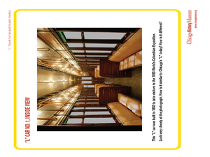
"L" Stands for Elevated
Young scholars play a trivia game to learn more about the Chicago public transportation system. For this transportation lesson plan, students also create an "L" car, and write advertising slogans for Chicago's elevated trains.
Curated OER
Planning A Railroad Online Lesson
Students plan a route across Donner Summit using topographical maps in order to understand the challenges involved in constructing the railroad in the Sierra Nevada Mountains. In this history lesson, students first discover how to read...
Curated OER
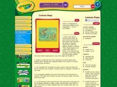
Contour Maps
Students review various contour maps, including local ones, to identify landforms such as mountains and plains. They create a 3-D contour map of an imaginary location that shows at least 10 changes in elevation. Afterward, they write a...
Curated OER
Layers with Lines
Students examine topographical maps and the challenges faced by cartographers when drawing the maps. While creating collages, they use contour lines to add dimension much in the same way they are used on maps to show elevation.
Curated OER
What Do Maps Show?: Lesson 4 How to Read a Topographic Map
Students examine the use of topographic maps as two dimensional representations that show elevations and slopes with contour lines. They read maps of the Salt Lake City, Utah area and complete the associated worksheets that show map...
Curated OER
The Geography of the Indian Subcontinent
Gloriously adorned with a glimpse of the Taj Mahal, these slides detail important facts and characteristics of South Asian cultures, such as India, Pakistan, Afghanistan, and several other surrounding countries. Slides cover the...
K20 LEARN
The Emancipation Proclamation: Expanding The Goals Of The Civil War
Should Juneteenth be recognized as a national holiday? To prepare to take a stance on this question, young historians first analyze the Emancipation Proclamation and compare it to Lincoln's first Inaugural Address. Scholars then read an...
Curated OER
Damage Control
Students investigate artificially elevated regions or cities around the world to compare histories, cultures, and strategies related to potential flooding disaster.
Curated OER
Planning A Railroad
Students use topographical maps students explain the challenges involved in building the railroad in the Sierra Nevada mountains.
Curated OER
Designing a Hiking Trail
Put your students' map skills to the test with this engaging cross-curricular project. Given the task of developing new hiking trails for their local community, young cartographers must map out beginner and intermediate paths that meet a...
Curated OER
Arizona
Students engage in a series of lessons about Arizona. They perform experiments and participate in activities across the curriculum. They perform research on websites imbedded in this plan to complete a variety of tasks.
C-SPAN
Should States Shift to Mail-In Voting during the Coronavirus Pandemic?
With the coronavirus pausing many norms in American society, officials are trying to decide how to safely hold voting in the 2020 presidential election. Using curated video clips, including speeches from Congress, journalists, and...
Curated OER
Topography: Know the topography of your neighborhood
Young scholars read and identify features on a topography map. In this topography lesson plan, students learn how to read a topography map, and then go out and take pictures of their own and discuss the topography pictures they took.
Curated OER
Generate an Accurate Landscape Profile from a Topographic Map
Learners enerate an accurate landscape profile from a topographic map. They determine the correct interval needed to accurately graph the change in elevation on a single piece of graph paper.
Curated OER
Farming: Seasons on a Wheat Farm (Lesson 4)
Pupils explain the seasons on a wheat farm. They identify the uses of a grain elevator as well. They use a dry erase board to illustrate the seasons and the grain elevator in operation.
Curated OER
Census Countdown
Students read and discuss the census and how the census is used by the government. In this census lesson plan, students use the data collected to compare different census's and their outcomes.
Curated OER
Excavation reveals a village buried by 1815 volcanic blast
Pupils create a photo essay depicting how natural features have impacted their town. In this natural features lesson plan, students read about a volcanic blast, answer comprehension questions about it, and then discuss how natural...
Curated OER
Centers of the Storm: The Lyceum and the Circle at the University of Mississippi
Greek Revival architecture and the Civil Rights Movement? Sure! Examine how the Lyceum and Circle, two historic buildings located on the campus of the University of Mississippi, relate to integration and the 1962 riot on the university...


