Curated OER
From the Heights to the Depths
Students create a relief map of Asia and Australia. They work in small groups on sections of the map to make one complete map of the continents.
Curated OER
World: Continents
In this blank outline map worksheet, students note the political boundaries of the continents of the world on a Robinson projection map.
Curated OER
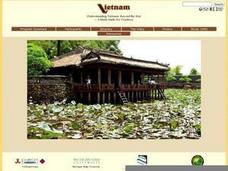
Geography of Vietnam
Ninth graders examine the geography of Vietnam. In this Geography lesson, 9th graders create a physical and political map of Vietnam.
Curated OER
The 13 British Colonies
In this British colonies historical map learning exercise, students examine the political boundaries of the 13 original colonies.
Curated OER
A Brief History of Vietnam (1858-2004) and Its Evolving Communist System
Students examine the French colonization of Vietnam, the Vietnam War, and the current evolving Communist system. They develop political maps, outline the major events of the Vietnam War, write an essay, and compare/contrast democracy...
Curated OER
Book: Germany
Students, after reading Chapter One in the book, "Germany," analyze and recreate the political boundaries as well as the physical features of the nation of Germany with the assistance of play-doh or salt dough. In groups, they create...
Curated OER
Oil: The Problem or Solution to the World's Economic Future
Students map the major oil producing and consuming countries and regions. They identify current and future topographic and political problems that could affect the production and transportation of oil.
Curated OER
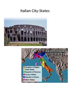
Italian City-States
Check out this packet of worksheets involving mapping activities, vocabulary logging, reading and comprehending informational texts, etc., which focuses on Italian city-states during the fourteenth and fifteenth centuries. There are also...
Curated OER
A Visit to China
Sixth graders study the history of China. They explore the Chinese people, the Great Wall of China, religions, government and Dynasties. In groups, 6th graders collect information on China. They write a report on their findings and...
Defining US
Integration of Education and American Society
How did the struggle for Civil Rights during the 1950s transform American society and politics? Why are American schools integrated today? Class members explore these essential questions by examining a series of primary and secondary...
Agriculture in the Classroom
Growing a Nation: Into a New Millennium 1970-Present
If you want to focus on critical thinking skills, this well-constructed series of activities will challenge your history or agriculture class to evaluate the effectiveness of administrative decisions related to agricultural and the...
Curated OER
Deutschland und die Europäische Union (Germany and the European Union)
Introduce your language learners in German class to the European Union, including the historic developments, the current structure, and some of the political and social principles behind it with this instructional activity. In small...
Curated OER
Populism & the Election of 1896
Populism and the rise and fall of the Populist Party are the topics of this presentation, which details the Presidential Election of 1896 and the role of silver. Detailing main points with clever political cartoons and informative maps,...
The New York Times
Kiev in Chaos: Teaching About the Crisis in Ukraine
Provide a historical context for the political unrest between Russia and Ukraine that began in late 2013. Learners review their prior knowledge and chronicle new understandings with a KWL chart, watch a video explaining the Ukrainian...
iCivics
Drafting Board: Interest Groups
Does the influence of interest groups harm a political system? Your class members will analyze the role of interest groups in American politics, as well as consider the effect of perspective, bias, loyalty, and the...
Curated OER
Overland Trails To The West
After observing a map of trails that settlers took in the 1800s, your class will write a journal with the perspective of a settler. In their journals, they must describe the trail they traveled, geographical features they saw, states and...
Curated OER
Maryland’s Chesapeake Bay Landscape Long Ago and Today
Combine a fantastic review of primary source analysis with a study of Captain John Smith's influence on the Chesapeake Bay region in the seventeenth century. Your young historians will use images, a primary source excerpt, and maps...
Theodore Roosevelt Association
Roosevelt's Legacy: Conservation
The legacy of Theodore Roosevelt carries through modern American politics, economics, foreign policy, and society. But his proudest and most profound efforts were in the world of conservation, and in preserving the natural beauty of...
Curated OER
The Mekong River
Junior geographers explore the region through which the Mekong flows, its pathway, the landscape, how people depend on the Mekong, and future uncertainties. They apply the five themes of geography to examine the region. They create a...
Curated OER
The Path of the Black Death
Students analyze maps, firsthand accounts, and archival documents to trace the path and aftermath of the Black Death. Connections between the plague and changes adopted by the ruling class are explored in this lesson.
Curated OER
Ann Arbor Growth & Immigration
Third graders describe some of the factors that brought early settlers to Ann Arbor. They read Narrative-A Trip from Utica, New York, to Ingham County, Michigan in 1838. As an added challenge, 3rd graders can use maps to track Silas...
Mesa Public Schools
Country Project
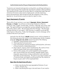
Give your young learners the chance to discover more about countries in their world community with a research project. Class members write reports on an assigned country and include such major features as geography, important historical...
Curated OER
And Your Point Is . . .? Part II
After researching recent community or political issues, paired with a review of proper debate format, class members select a topic, adopt a side, and prepare for a debate. The value in this resource is the review of debate procedures,...
Curated OER
How Do Artists Effectively Relate Historic Events?
Learners explore African American migration. In this black culture and history lesson, students use a map to identify northern and southern states in which African Americans lived in the 1900s. Learners observe and describe objects and...
Other popular searches
- Wwi Political Map
- Maps of Europe Political
- Physical and Political Maps
- Canada Political Map
- Americas Political Map
- Blank Political Maps
- Political Map of Africa
- United Kingdom Political Map
- Europe Political Map
- Physical & Political Maps
- Mexico Political Map
- State Political Maps


