Alabama Department of Archives and History
La Mobile: A Case Study of Exploration and Settlement
The Le Moyne brothers, Jean-Baptiste and Pierre, were among the first explorers of the Gulf Coast. Class members read biographical information and journal entries about these men, study maps showing where the settlements they established...
Curated OER
Crises in the Late Medieval Church
Corruption and power misuse about, the medieval church is on its last legs by the time this presentation is finished. Using inventive flow charts and maps to illustrate the growing crises between the church and medieval society, students...
Curated OER
The Brief American Pageant: The American People Face a New Century
The political landscape of Y2K is the focus of this series of slides, which cover the later years of the 20th century. Charts detail the poverty and social welfare rates in the 20th century, as well as a pie graph displaying the sources...
Curated OER
Comparative Religions: Islam
Engage theologians through online text resources during this comparative religions activity. Designed to interact with the online Glencoe text World History, there are many free tools on this site that stand alone. Scholars read the...
Curated OER
Do We Still Need the Electoral College?
One of the most confusing aspects of any presidential election year is the role of the Electoral College. Learners read a bit about how the Electoral College works and then they hold a mock election in their classroom. They'll redraw a...
Curated OER
Discovering Dinosaurs: Planning your Summer Vacation
Students use the online Atlas of Canada to gather information about places in Canada.
Curated OER
Globe Skills Lesson 10 Apollo 11
Students develop their globe skills. For this geography skills lesson, students use a globe and a softball to replicate distance between the earth and its moon.
Curated OER
Hemispheres & Continents
Students learn in cooperative learning groups to determine how the equator and the Prime Meridian divide the earth into hemispheres and use Venn diagrams. Students will locate and label the hemispheres, continents, and oceans.
Curated OER
Mapwork: A Place In the News
Students determine how to find geographic information about places they read about in the news. In this geography activity, students look at political and physical maps to determine the difference. They access maps online to find the...
Curated OER
Setting Boundaries
Students investigate the determination of the boundaries of various countries. They work in small groups to research a country's political history and past boundary issues and territorial disputes.
Curated OER
Reaching Across Borders In Southern Africa
Students gain a greater understanding of how political borders impact human and environmental development. Then, either individually or as a class, establish a correspondence with a Peace Corps volunteer working in Africa.
Curated OER
Nunavut, Our Communities
Students locate the communities of Nanavut on a territorial map and identify community characteristics. They research the online Atlas of Canada
Curated OER
Look! You're Wearing Geography
Sixth graders explore economic systems. In this economics lesson plan, 6th graders discover global markets. Students work in small groups to identify where their clothing and materials originated. Students locate countries on a map and...
Curated OER
Welcome to the Americas
Young scholars research and map the North and South American continents. For this geography lesson on the Americas, students can locate North, Central and South American countries and states. Young scholars choose a location to research...
Curated OER
Third Grade Social Studies-Multiple Choice Activity
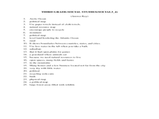
In this grade 3 social studies worksheet, 3rd graders complete a set of 25 questions about a variety of topics including geography, types of communities, map and questions about the environment.
Curated OER
Map-Making Basics
Students study maps. In this geography and art lesson, students create their own map of the classroom.
Curated OER
Canada Data Map
Students collect data and analyze it. In this algebra lesson, students collect data on the population characteristic in different regions. They use population, culture, settlement and others to help in their criteria.
Curated OER
The Sugar Cane Curtain/ Defining Political and Social Struggles Between Haiti and the Dominican Republic
Twelfth graders explore historical events that created conflict between Dominican Republic and Haiti, examine how need for cheap source of labor has led to exploitation of Haitian workers, and discuss how topography of island of...
Curated OER
Puerto Rico: The 51st State?
Students explore Puerto Rico. In this Puerto Rico current events lesson, students conduct a Webquest to answer questions about Puerto Rico's culture. Students discuss whether Puerto Rico is a country or a state, and defend...
Curated OER
Expanding the Story of the Montgomery Bus Boycott
Introduce the class to the Civil Rights Movement by taking a critical look at the Montgomery Bus Boycott in 1955. They will pay close attention to the role women played in organizing the boycott and bringing national attention to the...
Curated OER
The Election of 1844
Briefly detailing the goals and issues within the Polk election and presidency, this presentation can help your students to bridge their knowledge of American politics and issues prior to the Civil War. It includes photographs of Polk,...
Curated OER
Regents High School Examination: Global History and Geography, 2009
Get your geographers thinking with this global history and geography standardized practice test. Class members respond to 50 multiple choice questions, 2 essay prompts, and 15 short answer questions that require them to review their...
Curated OER
1792 Election Results
The beginning of American politics and elections is found in these slides, which detail the 1792, 1796, 1800 elections of Washington, Adams, and Jefferson (respectively). Plan on including your own discussion points and details in this...
Curated OER
The War of 1812
A good addition to a unit on the War of 1812, this slideshow details causes, specific battles, political contexts, and several campaigns of the war. Maps and pictures with broad topics allow teachers to bring their own discussion topics...
Other popular searches
- Wwi Political Map
- Maps of Europe Political
- Physical and Political Maps
- Canada Political Map
- Americas Political Map
- Blank Political Maps
- Political Map of Africa
- United Kingdom Political Map
- Europe Political Map
- Physical & Political Maps
- Mexico Political Map
- State Political Maps


