Curated OER
Maps and the Pictures in Our Heads
Geographers of all ages examine different types of maps. They draw maps of their environment, utilizing both three-dimensional and picture maps. They interpret map information, noting how it can sometimes be misleading. Some good...
Royal Geographical Society
An Introduction to Maps
First graders are introduced to a variety of maps such as globes, street maps, atlases, and different types of floor plans. The focus of the lesson requires individuals to create their own plan of the classroom using the PowerPoint...
Radford University
Streets of Stephens City
Who has the best street smarts? An educational lesson has future mathematicians analyze street maps and measure angles on the map to determine if streets are parallel. They also consider safety issues at different types of intersections.
Agriculture’s Lasting Heritage
Apples Around Us
Apple tasting launches an investigation of the story and travels of John Chapman, also known as Johnny Appleseed. After listening to his story, class members craft a summary of the tale, chart his journeys on a map, and sample different...
Curated OER
Size It Up: Map Skills
Compare information from a US population cartogram and a standard US map. Learners draw conclusions about population density by analyzing census data a population distribution. They discover that census data is used to apportion seats in...
Rainforest Alliance
Knowing the Essential Elements of a Habitat
To gain insight into the many different types of habitats, individuals must first get to know their own. Here, scholars explore their school environment, draw a map, compare and contrast their surroundings to larger ones. They then...
Oregon State
World Map of Plate Boundaries
Young geologists piece together the puzzle of plate tectonics in an earth science lesson. Given a physical map of the world, they search for land formations that indicate the location of different types of plate boundaries.
Texas Heart Institute
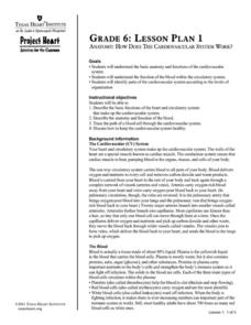
Anatomy: How Does the Cardiovascular System Work?
How can the circulatory system compare to a city map? Pupils distinguish the "roadways" and "vehicles" of the cardiovascular system, compare the anatomy and function of veins and arteries, and review different types of blood cells with...
Agriculture in the Classroom
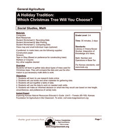
A Holiday Tradition: Which Christmas Tree Will You Choose?
Different varieties of Christmas trees provide an interesting way to combine social studies, science, math, and technology. Class members not only research the history of the Christmas tree holiday tradition, they compare and...
Curated OER
Map Projections
Learners view examples of various map projections using a website. Students record differences between the map projections. Learners discuss uses for the various map projections and the differences between the maps they viewed. ...
Curated OER
Symmetries of a Quadrilateral I
Learners examine the properties of quadrilaterals from the point of view of rigid motion. Different types of quadrilaterals are characterized by their symmetries, so learners explore the symmetries of a described quadrilateral to...
Compton Unified School District
How Can We Locate Places?
How can we locate places? Maps, of course! Expose second graders to the tools available in maps and discuss how these tools can help people find locations. Students also look at communities, including what makes a community and the...
Curated OER
The Water Around Us
Students discuss importance of reading maps and knowing about the geography of the United States, and locate bodies of water on different types of maps and examine how they are used in the state or local community.
Curated OER
Waldseemuller's Map: World 1507
Students investigate the 1507 word map. In this world geography lesson, students examine the details of each section of the map and then draw conclusions about how the people of 1507 understood the world. Students are evalated on...
US Environmental Protection Agency
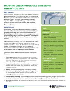
Mapping Greenhouse Gas Emissions Where You Live
After investigating the US Environmental Protection Agency's climate change website, your environmental studies students discuss greenhouse gas emissions. They use an online interactive tool to look at data from power production...
Curated OER
Types of Transportation
Pupils identify and describe various modes of transportation. For this transportation lesson, students discuss the types of transportation shown in the Landscape Picture and discuss the purpose of that vehicle. Pupils locate examples of...
Teach Engineering
What is GIS?
Is GIS the real manifestation of Harry Potter's Marauders Map? Introduce your class to the history of geographic information systems (GIS), the technology that allows for easy use of spatial information, with a resource that teaches...
Association of American Geographers
Project GeoSTART
Investigate the fascinating, yet terrifying phenomenon of hurricanes from the safety of your classroom using this earth science unit. Focusing on developing young scientists' spacial thinking skills, these lessons engage...
Curated OER
Landscape Picture Map
Young scholars identify a neighborhood on a Landscape Picture Map. In this geography lesson, students discuss the characteristics of their neighborhood and identify their neighborhood on a Landscape Picture Map. Young scholars use...
Curated OER
Weather Maps
Students interpret information on a weather map in order to construct a graph, and discuss how the weather impacts their lives.
Curated OER
Using Local Geography to Make Maps
Learners research, create, and present a scale representation of the county in which they live.
Teach Engineering
Stormy Skies
Young meteorologists examine the four main types of weather fronts and how they appear on a weather map. Participants learn about the difference between the types of weather fronts along with their distinguishing features. A...
Curated OER
Earth's Water
If the majority of our planet is covered with water, why do we need to bother conserving it? With a thorough and varied investigation into the location and types of water on the earth, learners will gain an understanding of why this...
Food Project
Trace The French Fry
How does locally grown produce sold at a farmer's market compare to a more complex industrial system in the way they each affect the environment, people, and the economy? Pupils explore the different types of food systems and how they...


