Richmond Community Schools
Map Skills
Young geographers will need to use a variety of map skills to complete the tasks required on this learning exercise. Examples of activities include using references to label a map of Mexico, identify Canadian territories and...
Public Schools of North Carolina
Democratic Republic of Congo - Map Skills
Work on your map skills with a packet of activities about the river basins in the Democratic Republic on Congo. Learners study the maps provided before answering the geography questions and writing an acrostic poem about the region.
National Geographic
Mapping the Americas
Celebrate the geography of the Americas and develop map skills through a series of activities focused on the Western Hemisphere. Learners study everything from earthquakes and volcanoes of the Americas and the relationship...
Owl Teacher
Creating a Map to My House
Here is a simple assignment that will introduce your young geographers to location, one of the five themes of geography, through an activity in which they map the directions and lines of latitude/longitude of where they live.
Luminations Media Group
Geography: Map Reading Basic Skills
Enhance scholars' map skills using this worksheet displaying the land of Kahitsa’an from the series, The Realm, by K.L. Glanville. The activity helps readers visualize the make believe-land, examine its attributes, and answer...
Ed Helper Clip Art
USA States
Looking for a map of the Unites States of America? Look no further than this printable map designed to accompany your geography instruction and to give map skills a boost.
Curated OER
John Smith’s Map of the Chesapeake Bay
Young geographers travel back through time with primary source and map analysis and envision Captain John Smith's arrival at the Chesapeake Bay.
Royal Geographical Society
An Introduction to Maps
First graders are introduced to a variety of maps such as globes, street maps, atlases, and different types of floor plans. The focus of the lesson requires individuals to create their own plan of the classroom using the PowerPoint...
National Museum of the American Indian
The A:Shiwi (Zuni) People: A Study in Environment, Adaptation, and Agricultural Practices
Discover the connection of native peoples to their natural world, including cultural and agricultural practices, by studying the Zuni people of the American Southwest. This lesson includes examining a poster's photographs, reading...
Oregon State
World Map of Plate Boundaries
Young geologists piece together the puzzle of plate tectonics in an earth science lesson. Given a physical map of the world, they search for land formations that indicate the location of different types of plate boundaries.
NASA
Outline Maps
Don't miss this gold mine of blank maps for your next geography lesson! Regions include traditional continents such as Asia, Europe, and Africa, as well as other major world areas such as the Pacific Rim and the Middle East.
National Endowment for the Humanities
Hopi Place Names
What's in a name? Historians consider the question as they examine places important to the Hopi people and the meanings of their place names. Included worksheets include maps and charts to help class members examine the geography of Hopi...
New York State Education Department
Global History and Geography Examination: June 2011
People in Ukraine, Rwanda, and Cambodia have all faced challenges to their human rights and even genocide. Using primary and secondary sources, scholars evaluate these challenges and the international community's role in them. The...
California Polytechnic State University
Australian Geography Unit
At the heart of this resource is a beautifully detailed PowerPoint presentation (provided in PDF form) on the overall physical geography of Australia, basic facts about the country, Aboriginal history, and Australia culture and lifestyle.
Space Awareness
How To Travel On Earth Without Getting Lost
Have you ever wanted to travel the world? Take a virtual trip with a geography lesson that uses longitude and latitude, the position of the sun, an astronomy app, and a classroom globe.
Scholastic
Volleyball Road Trip
Review coordinate mapping with your young geographers by matching cities on a volleyball team's road trip itinerary to their appropriate coordinate locations.
Geophysical Institute
Latitude and Longitude with Google Earth
Travel the world from the comfort of your classroom with a lesson that features Google Earth. High schoolers follow a series of steps to locate places all over the earth with sets of coordinates. Additionally, they measure the distance...
Huntington Library
The Corps of Discovery: The Lewis and Clark Expedition
Don't miss this fantastic comprehensive lesson plan on the Lewis and Clark Expedition, packed with instructional guidance, worksheets, map work, informational texts, and secondary source materials.
Latin America Network Information Center
Urbanization
Brazil's population has been changing dramatically in the last century. Study the causes of Brazilian urbanization, including industrialization and and migration, and the implications for the country of the populations'...
Association of American Geographers
Project GeoSTART
Investigate the fascinating, yet terrifying phenomenon of hurricanes from the safety of your classroom using this earth science unit. Focusing on developing young scientists' spacial thinking skills, these lessons engage...
Curated OER
Learn the States and Postal Abbreviations
If you are preparing to cover the 50 states with your class, you don't want to miss this resource. It includes an excellent set of worksheets through which learners practice identifying states from their abbreviations and placing those...
Cassandra Reigel Whetstone
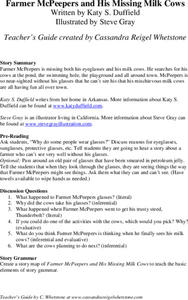
Farmer McPeepers and His Missing Milk Cows
Pair your reading of Farmer McPeepers and His Missing Milk Cows with the questions and activities provided here. Learners answer questions about the text, create story maps, put together brochures, relate math to the story, practice...
August House
The Archer and the Sun
Reinforce reading comprehension with a instructional activity about The Archer and the Sun, a Chinese folktale. Kids learn some background information about Chinese culture before reading the story, and answer literacy...
New York State Education Department
US History and Government Examination: August 2010
Geography has played a complex role in America history. The Atlantic Ocean has served as a buffer to protect the United States from European Wars, but its proximity to Cuba, however, left it vulnerable to nuclear war during the Cuban...
Other popular searches
- Geography Map Skills Scale
- Geography Map Skills Europe
- Usa Geography Map Skills
- Geography Map Skills Us
- Canada Geography Map Skills
- Map Skills Geography Themes
- Geography Map Skills Ohio
- Map Skills Geography


