Curated OER
Korea Cultural Lesson Plan
Students engage in a study of geography and maps of Korea. They examine charts and graphs. Students are expected to interpret the information accurately and completely. The geography skills can be used on other countries as well.
Curated OER
Globe Lesson 5 - Latitude - Grade 6+
In this latitude learning exercise, students read a 3-paragraph review of latitude and respond to 12 short answer questions.
Curated OER
Jamestown Journey Part 4
Fourth graders review their prior knowledge from the previous lessons of this unit on Jamestown. After reading a novel, they examine and discuss the life of Pocahontas. Using the internet, they answer comprehension questions and write...
Curated OER
Jamestown Journey Part 3
Fourth graders study the economy of Jamestown. In this early settlers lesson, 4th graders read about the trade between the English and the natives in Jamestown. This lesson is part of a larger unit and coincides with the novel The Double...
Curated OER
Scrambled States
Learners read or are read the story "Scrambled States". Using a map, they identify their states and time zones. They predict their states representation in the book and discuss it after the book is finished. They discvor the differences...
Curated OER
The Slave Trade
Students map and explore a possible slave trade route. In this slave trade mapping lesson, students calculate the distance and amount of time it would take for African slaves to arrive in America.
Curated OER
Geography of the English Settlements
Third graders locate several important American colonial cities on a map and research how their proximity to water and nearby arable land affected the rate and success of settlement.
Curated OER
Immigration in the Connecticut River Valley
Students discuss and compare immigration during the 18th century to the Connecticut River Valley to that in America during the turn of the century.
Curated OER
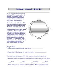
Latitude
In this latitude worksheet, students answer questions about latitude that include absolute locations of countries and coordinates. Students complete 12 questions.
PBS
Make a Balloon Globe
"We've got the whole world in our hands," is what your students will be singing after completing this fun geography activity. Using the included templates for the seven continents and a balloon, they create their very own globes.
Curated OER
The Age of Exploration
Students apply computer skills to gain further insight into early exploration. They analyze the role of each explorer and evaluate their importance. Students comprehend the Chronology of Discovery and Trade of early explorers. They...
Curated OER
The Biggest Plates on Earth
The best part about teaching guides is all the great information you can use to inform your class. They infer what type of boundary exists between two tectonic plates. Then, using given information on earthquakes and volcanism they'll...
Curated OER
Using MY NASA DATA to Determine Volcanic Activity
Students explore how aerosols are used in science to indicate volcanic activity and how biomass burning affects global aerosol activity. Students access data and import into MS Excel using graphical data to make inferences and draw...
American Museum of Natural History
Inca Investigation
A fascinating interactive resource lets young archaeologists dig through the history of Huanuco Pampa. The Inca city, located high in the Andes mountains of Peru, was once a thriving community. Craig Morris has spent years researching...
Agriculture in the Classroom
Pumpkins... Not Just For Halloween
Celebrate fall with four pumpkin themed hands-on activities! After learning about pumpkins, scholars complete two activity sheets that reinforce estimation and word problems. They then plant pumpkin seeds and bake a pie in...
Curated OER
Reading Comprehension 2
You scream, I scream! Young learners read this passage about ice cream flavors, then answer 13 questions about details from the reading. The questions address details from the text, vocabulary, and parts of speech. Use this activity to...
Curated OER
LIFE ON THE MISSISSIPPI PAST AND PRESENT
Third graders explore the Mississippi River and the ways in which it is used by the communities it travels through.
Rocklin Unified School District
Spanish Speaking Countries Project
Ask your class members to provide a tour of a Spanish speaking country with a brochure and flag project. Learners research their assigned country, making sure to check off each of the required pieces of information listed on the first...
Tech Know Teaching
5th Grade Constructed Response Question
New to constructed response question worksheets? Here's a model that demonstrates how to construct questions that require readers to interpret graphics found in informational text.
Curated OER
Ecosystems Lesson Plan
Students research ecosystems (rainforest, desert, grassland, woodland, and arctic tundra). Students compare the seven continents and the importance of proximaty to the equator.
Curated OER
The Tennessee River: The Tie That Binds
Seventh graders examine the Tennessee River to see why it is still a major transportation artery in lieu of the age of modern transportation such as interstate highways, air cargo, and elaborate railway systems.
Curated OER
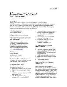
Chop, Chop, Who's There?
Students write a letter of persuasion about the problems facing the rainforest. They examine and write about how humans are destroying the rainforest.
Curated OER
Wildlife
The centerpiece of this lesson plan is a predator-prey simulation in which colored paperclips represent different species of animals camouflaged against a colored background. Relevant follow-up questions are provided. The activity is...
Curated OER
Where In the World Am I?
Learners identify their location in the world after studying latitude, longitude, relative location, and absolute location. They use assigned web site to find information to make a flipbook that answers questions about their location in...
Other popular searches
- Map of South America
- Reading Maps South America
- South America Map 1500
- South America Map `500
- South America Map Worksheet
- Physical Map of South America
- South America Map 500
- South America Map Skills
- Maps South America
- South America Map \`500
- Choropleth Map South America
- Blank Map South America


